|
search place name
|
||
Rodemer (Kentucky, United States - USA)Rodemer is a town in the Kentucky region of United States - USA. An overview map of the region around Rodemer is displayed below.
regional and 3d topo map of Rodemer, United States - USA ::

Rodemer airports ::
The nearest airport is BNA - Nashville Intl, located 77.3 km south west of Rodemer.
Other airports nearby include HOP - Hopkinsville Campbell Aaf (113.3 km west), FTK - Fort Knox Godman Aaf (133.8 km north), LOU - Louisville Bowman Fld (174.8 km north), CHA - Chattanooga Lovell Fld (208.5 km south east), Nearby towns ::
Petroleum (3.1km south west) //
Scottsville (5.1km north east) //
Chapel Hill (5.6km west) //
Red Hill (6.7km west) //
Adolphus (8.0km south) //
West Fork (8.4km north west) //
Forest Springs (9.1km south east) //
Fleet (9.3km south west) //
Halfway (10.4km north west) //
[all distances 'as the bird flies' and approximate] 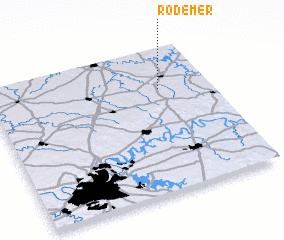 Places with similar names to Rodemer, United States - USA ::
// Rio do Amaro (BR)
// Reitmaier (DE)
// Reitmoor (DE)
// Rettmer (DE)
// Rottmar (DE)
// Redemouro (PT)
// Rio de Mouro (PT)
// Raudmyr (NO)
// Radomirë (AL)
// Radomir (BG)
Disclaimer :: Information on this page comes without warranty of any kind |
||
|
Where is Rodemer? Elevation and coordinates ::
Latitude (lat): 36°43'9"N Longitude (lon): 86°13'46"W
Elevation (approx.): 239m (map arrows pan, magnifying glasses zoom) |
||
|
Visiting Rodemer? Hotel/Accommodation ::
Book a hotel in Rodemer Travel Guide ::
rental cars ::
car rental offers GPS waypoint ::
download a GPX waypoint (PoI) of Rodemer for your GPS receiver
|
||