|
search place name
|
||
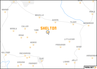
Shelton (Kentucky, United States - USA)Shelton is a town in the Kentucky region of United States - USA. An overview map of the region around Shelton is displayed below.
regional and 3d topo map of Shelton, United States - USA ::
Shelton airports ::
The nearest airport is HOP - Hopkinsville Campbell Aaf, located 103.4 km south of Shelton.
Other airports nearby include FTK - Fort Knox Godman Aaf (165.1 km east), BNA - Nashville Intl (188.7 km south east), HUF - Terre Haute Intl Hulman Fld (213.3 km north), MKL - Jackson Mc Kellar Sipes Rgnl (240.3 km south west), Nearby towns ::
Yuba (3.8km west) //
Givens (5.2km north east) //
Free Union (6.1km south east) //
Hearin (6.1km south west) //
Boxville (7.2km north west) //
Bordley (6.6km west) //
Little Zion (7.0km south east) //
Williams (7.5km south west) //
Wheatcroft (10.5km south west) //
[all distances 'as the bird flies' and approximate]  Places with similar names to Shelton, United States - USA ::
Disclaimer :: Information on this page comes without warranty of any kind |
||
|
Where is Shelton? Elevation and coordinates ::
Latitude (lat): 37°34'7"N Longitude (lon): 87°47'46"W
Elevation (approx.): 136m (map arrows pan, magnifying glasses zoom) |
||
|
Visiting Shelton? Hotel/Accommodation ::
Book a hotel in Shelton Travel Guide ::
rental cars ::
car rental offers GPS waypoint ::
download a GPX waypoint (PoI) of Shelton for your GPS receiver
|
||