|
search place name
|
||
Shopville (Kentucky, United States - USA)Shopville is a town in the Kentucky region of United States - USA. An overview map of the region around Shopville is displayed below.
regional and 3d topo map of Shopville, United States - USA ::

Shopville airports ::
The nearest airport is TYS - Knoxville Mc Ghee Tyson, located 155.8 km south of Shopville.
Other airports nearby include FTK - Fort Knox Godman Aaf (155.9 km north west), LOU - Louisville Bowman Fld (158.1 km north west), CVG - Cincinnati Northern Kentucky Intl (210.5 km north), LUK - Cincinnati Muni Lunken Fld (215.9 km north), Nearby towns ::
Mark (2.2km west) //
Valley Oak (3.5km north) //
Coin (3.2km north west) //
Welborn (4.7km north) //
Stab (3.9km east) //
Dahl (4.8km north east) //
Grundy (5.2km south west) //
Barnesburg (4.8km west) //
Bent (6.1km south east) //
Piney Grove (6.5km south) //
Elrod (6.8km north) //
Drum (7.2km south) //
Dabney (6.8km north west) //
Sinking Valley (7.0km east) //
Ula (8.0km south east) //
Sugar Hill (7.5km south west) //
Bobtown (8.3km north west) //
Vanhook (9.2km north east) //
Plato (9.9km north east) //
[all distances 'as the bird flies' and approximate] 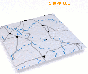 Places with similar names to Shopville, United States - USA :: Disclaimer :: Information on this page comes without warranty of any kind |
||
|
Where is Shopville? Elevation and coordinates ::
Latitude (lat): 37°9'31"N Longitude (lon): 84°28'48"W
Elevation (approx.): 268m (map arrows pan, magnifying glasses zoom) |
||
|
Visiting Shopville? Hotel/Accommodation ::
Book a hotel in Shopville Travel Guide ::
rental cars ::
car rental offers GPS waypoint ::
download a GPX waypoint (PoI) of Shopville for your GPS receiver
|
||