|
search place name
|
||
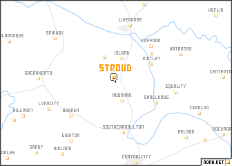
Stroud (Kentucky, United States - USA)Stroud is a town in the Kentucky region of United States - USA. An overview map of the region around Stroud is displayed below.
regional and 3d topo map of Stroud, United States - USA ::
Stroud airports ::
The nearest airport is HOP - Hopkinsville Campbell Aaf, located 87.7 km south of Stroud.
Other airports nearby include FTK - Fort Knox Godman Aaf (117.9 km north east), BNA - Nashville Intl (148.7 km south), LOU - Louisville Bowman Fld (159.5 km north east), MKL - Jackson Mc Kellar Sipes Rgnl (255.4 km south west), Nearby towns ::
Moorman (2.9km south) //
Island (4.1km north) //
Buttonsberry (4.4km north) //
Kirtley (5.5km north east) //
Smallhous (6.1km south east) //
Point Pleasant (6.6km north east) //
South Carrollton (8.0km south) //
Coffman (7.5km north east) //
Bremen (7.9km south west) //
[all distances 'as the bird flies' and approximate] 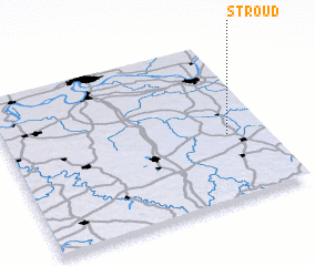 Places with similar names to Stroud, United States - USA ::
// Start (RU)
// Staryye Atai (RU)
// Zaouia Taouert (MA)
// Zaouiat Ourti (MA)
// Sterrett (US)
// Strata (US)
// Stroud (US)
// Stuart (US)
// Strad (AT)
// Stuart (US)
Disclaimer :: Information on this page comes without warranty of any kind |
||
|
Where is Stroud? Elevation and coordinates ::
Latitude (lat): 37°24'32"N Longitude (lon): 87°9'9"W
Elevation (approx.): 134m (map arrows pan, magnifying glasses zoom) |
||
|
Visiting Stroud? Hotel/Accommodation ::
Book a hotel in Stroud Travel Guide ::
rental cars ::
car rental offers GPS waypoint ::
download a GPX waypoint (PoI) of Stroud for your GPS receiver
|
||