|
search place name
|
||
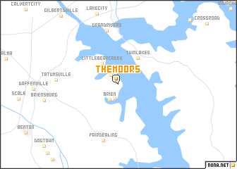
The Moors (Kentucky, United States - USA)The Moors is a town in the Kentucky region of United States - USA. An overview map of the region around The Moors is displayed below.
regional and 3d topo map of The Moors, United States - USA ::
The Moors airports ::
The nearest airport is HOP - Hopkinsville Campbell Aaf, located 70.5 km south east of The Moors.
Other airports nearby include MKL - Jackson Mc Kellar Sipes Rgnl (160.0 km south west), BNA - Nashville Intl (164.1 km south east), BYH - Blytheville Arkansas Intl (188.0 km south west), NQA - Millington Rgnl Jetport (229.0 km south west), Nearby towns ::
Sherwood Shores (0.5km north west) //
Buena Vista (1.3km north west) //
Cambridge Shores (1.8km north west) //
Birmingham (2.3km south) //
Brien (2.6km south west) //
Marshall (2.7km north west) //
Little Bear Creek (3.9km north west) //
Twin Lakes (4.9km north east) //
Grand Rivers (8.7km north) //
Fairdealing (9.0km south) //
[all distances 'as the bird flies' and approximate] 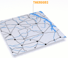
Disclaimer :: Information on this page comes without warranty of any kind |
||
|
Where is The Moors? Elevation and coordinates ::
Latitude (lat): 36°55'34"N Longitude (lon): 88°13'4"W
Elevation (approx.): 131m (map arrows pan, magnifying glasses zoom) |
||
|
Visiting The Moors? Hotel/Accommodation ::
Book a hotel in The Moors Travel Guide ::
rental cars ::
car rental offers GPS waypoint ::
download a GPX waypoint (PoI) of The Moors for your GPS receiver
|
||