|
search place name
|
||
Weeksbury (Kentucky, United States - USA)Weeksbury is a town in the Kentucky region of United States - USA. An overview map of the region around Weeksbury is displayed below.
regional and 3d topo map of Weeksbury, United States - USA ::

Weeksbury airports ::
The nearest airport is TYS - Knoxville Mc Ghee Tyson, located 204.9 km south west of Weeksbury.
Other airports nearby include HKY - Hickory Rgnl (211.0 km south east), LUK - Cincinnati Muni Lunken Fld (248.6 km north west), CVG - Cincinnati Northern Kentucky Intl (258.0 km north west), Nearby towns ::
Melvin (2.6km north) //
Wheelwright (2.9km west) //
Wheelwright Junction (3.8km north west) //
Ligon (4.9km north) //
Burton (4.7km north west) //
Wales (4.5km east) //
Halo (4.7km west) //
Speight (5.9km south) //
Hartley (5.2km east) //
Jacks Creek (5.8km north west) //
Buckingham (6.4km north west) //
Hi Hat (8.0km north west) //
Etty (8.5km south) //
Beaver (8.2km north) //
Dry Creek (7.1km west) //
Price (9.6km north west) //
Lionilli (10.1km south east) //
[all distances 'as the bird flies' and approximate] 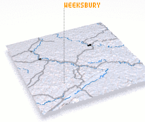 Places with similar names to Weeksbury, United States - USA ::
// Weeksboro (US)
Disclaimer :: Information on this page comes without warranty of any kind |
||
|
Where is Weeksbury? Elevation and coordinates ::
Latitude (lat): 37°19'40"N Longitude (lon): 82°41'18"W
Elevation (approx.): 346m (map arrows pan, magnifying glasses zoom) |
||
|
Visiting Weeksbury? Hotel/Accommodation ::
Book a hotel in Weeksbury Travel Guide ::
rental cars ::
car rental offers GPS waypoint ::
download a GPX waypoint (PoI) of Weeksbury for your GPS receiver
|
||