|
search place name
|
||
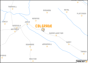
Colgrade (Louisiana, United States - USA)Colgrade is a town in the Louisiana region of United States - USA. An overview map of the region around Colgrade is displayed below.
regional and 3d topo map of Colgrade, United States - USA ::
Colgrade airports ::
The nearest airport is ESF - Alexandria Esler Rgnl, located 61.5 km south of Colgrade.
Other airports nearby include AEX - Alexandria Intl (64.7 km south), MLU - Monroe Rgnl (81.4 km north east), POE - Fort Polk Polk Aaf (114.5 km south west), BAD - Shreveport Barksdale Afb (124.9 km north west), Nearby towns ::
Murray Junction (4.7km east) //
Menefee (5.5km north west) //
Jordan Hill (6.4km south) //
Joyce (6.8km north west) //
Ringwood (8.2km north) //
New Moore (8.2km south west) //
Moore (9.1km south west) //
[all distances 'as the bird flies' and approximate]  Places with similar names to Colgrade, United States - USA ::
// Kalkreute (DE)
// Collegrato (IT)
// Kula Grad (BA)
// Goligrady (UA)
// Coolgardie (ZA)
// Colcord (US)
// Kālikirti (BD)
// Gallocrudo (CO)
// Kulgurt (KZ)
// Kolā Kardeh (IR)
Disclaimer :: Information on this page comes without warranty of any kind |
||
|
Where is Colgrade? Elevation and coordinates ::
Latitude (lat): 31°54'39"N Longitude (lon): 92°32'4"W
Elevation (approx.): 39m (map arrows pan, magnifying glasses zoom) |
||
|
Visiting Colgrade? Hotel/Accommodation ::
Book a hotel in Colgrade Travel Guide ::
rental cars ::
car rental offers GPS waypoint ::
download a GPX waypoint (PoI) of Colgrade for your GPS receiver
|
||