|
search place name
|
||
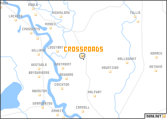
Cross Roads (Louisiana, United States - USA)Cross Roads is a town in the Louisiana region of United States - USA. An overview map of the region around Cross Roads is displayed below.
regional and 3d topo map of Cross Roads, United States - USA ::
Cross Roads airports ::
The nearest airport is BAD - Shreveport Barksdale Afb, located 43.7 km north west of Cross Roads.
Other airports nearby include SHV - Shreveport Rgnl (50.4 km north west), AEX - Alexandria Intl (123.9 km south east), GGG - Longview East Texas Rgnl (126.5 km west), ELD - El Dorado South Arkansas Rgnl At Goodwin Fld (127.1 km north east), Nearby towns ::
East Point (4.4km south west) //
New Hope (5.4km south west) //
Loggy Bayou (5.2km west) //
Mount Zion (5.7km south east) //
Crichton (7.7km south west) //
Halfway (8.4km south) //
Ninock (9.5km north west) //
[all distances 'as the bird flies' and approximate] 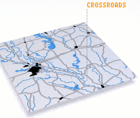 Places with similar names to Cross Roads, United States - USA ::
// Crossroads (US)
// Crossroads (US)
// Cross Roads (US)
// Cross Roads (US)
// Cross Roads (US)
// Cross Roads (US)
// Cross Roads (US)
// Cross Roads (US)
// Cross Roads (US)
// Crossroads (US)
Disclaimer :: Information on this page comes without warranty of any kind |
||
|
Where is Cross Roads? Elevation and coordinates ::
Latitude (lat): 32°11'0"N Longitude (lon): 93°23'23"W
Elevation (approx.): 80m (map arrows pan, magnifying glasses zoom) |
||
|
Visiting Cross Roads? Hotel/Accommodation ::
Book a hotel in Cross Roads Travel Guide ::
rental cars ::
car rental offers GPS waypoint ::
download a GPX waypoint (PoI) of Cross Roads for your GPS receiver
|
||