|
search place name
|
||
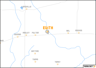
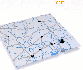
Edith (Louisiana, United States - USA)Edith is a town in the Louisiana region of United States - USA. An overview map of the region around Edith is displayed below.
regional and 3d topo map of Edith, United States - USA ::
Edith airports ::
The nearest airport is DRI - Deridder Beauregard Rgnl, located 39.2 km north west of Edith.
Other airports nearby include LCH - Lake Charles Rgnl (43.7 km south), POE - Fort Polk Polk Aaf (58.7 km north), BPT - Beaumont Southeast Texas Rgnl (104.2 km south west), AEX - Alexandria Intl (107.0 km north east), Nearby towns ::
 Places with similar names to Edith, United States - USA ::
Disclaimer :: Information on this page comes without warranty of any kind |
||
|
Where is Edith? Elevation and coordinates ::
Latitude (lat): 30°30'58"N Longitude (lon): 93°9'20"W
Elevation (approx.): 23m (map arrows pan, magnifying glasses zoom) |
||
|
Visiting Edith? Hotel/Accommodation ::
Book a hotel in Edith Travel Guide ::
rental cars ::
car rental offers GPS waypoint ::
download a GPX waypoint (PoI) of Edith for your GPS receiver
|
||