|
search place name
|
||
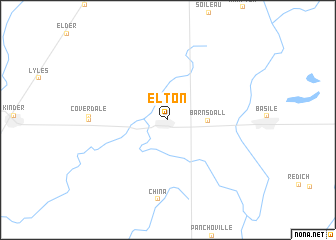
Elton (Louisiana, United States - USA)Elton is a town in the Louisiana region of United States - USA. An overview map of the region around Elton is displayed below.
regional and 3d topo map of Elton, United States - USA ::
Elton airports ::
The nearest airport is LCH - Lake Charles Rgnl, located 64.2 km south west of Elton.
Other airports nearby include DRI - Deridder Beauregard Rgnl (73.0 km north west), LFT - Lafayette Rgnl (74.6 km south east), POE - Fort Polk Polk Aaf (78.5 km north west), AEX - Alexandria Intl (94.9 km north), Nearby towns ::
Barnsdall (3.9km east) //
Coverdale (7.6km west) //
Lauderdale (7.6km west) //
China (8.9km south) //
[all distances 'as the bird flies' and approximate] 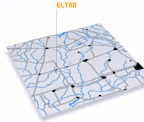 Places with similar names to Elton, United States - USA ::
Disclaimer :: Information on this page comes without warranty of any kind |
||
|
Where is Elton? Elevation and coordinates ::
Latitude (lat): 30°28'52"N Longitude (lon): 92°41'44"W
Elevation (approx.): 18m (map arrows pan, magnifying glasses zoom) |
||
|
Visiting Elton? Hotel/Accommodation ::
Book a hotel in Elton Travel Guide ::
rental cars ::
car rental offers GPS waypoint ::
download a GPX waypoint (PoI) of Elton for your GPS receiver
|
||