|
search place name
|
||
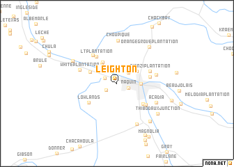
Leighton (Louisiana, United States - USA)Leighton is a town in the Louisiana region of United States - USA. An overview map of the region around Leighton is displayed below.
regional and 3d topo map of Leighton, United States - USA ::
Leighton airports ::
The nearest airport is MSY - Louis Armstrong New Orleans Intl, located 61.9 km east of Leighton.
Other airports nearby include NBG - New Orleans Nas Jrb (79.6 km east), BTR - Baton Rouge Metro Ryan Fld (86.4 km north), LFT - Lafayette Rgnl (118.1 km north west), BIX - Biloxi Keesler Afb (198.4 km east), Nearby towns ::
Naquin (1.7km south east) //
Waverly Mobile Home Park (1.8km south west) //
Brule (1.9km north west) //
Greenwood Acres (2.1km north) //
Greewood Plantation (2.2km north west) //
Abby Plantation (2.4km north east) //
Elmer (2.6km north) //
Coulon Plantation (3.4km north east) //
Laurel Grove (3.6km north west) //
Thibodaux (3.4km east) //
Laurel Grove Plantation (4.0km north west) //
Morvant (4.2km north west) //
Acadian Villa (4.9km south east) //
Plantation Acres (4.7km east) //
L T Plantation (5.1km north west) //
Lowlands (5.0km south west) //
Rienzi Plantation (5.0km north east) //
Johnson Ridge (5.3km south east) //
Dixie Plantation (5.6km north west) //
White Plantation (5.6km north west) //
Twelve Cedars (5.7km east) //
Choupique (6.9km north) //
Acadia (6.3km south east) //
Country Hollow (7.1km south east) //
Orange Grove Plantation (7.4km north east) //
Saint Rose Plantation (7.1km north west) //
Schriever (7.6km south east) //
Thibodaux Junction (7.4km south east) //
Brandywine (8.1km east) //
[all distances 'as the bird flies' and approximate]  Places with similar names to Leighton, United States - USA ::
Disclaimer :: Information on this page comes without warranty of any kind |
||
|
Where is Leighton? Elevation and coordinates ::
Latitude (lat): 29°47'47"N Longitude (lon): 90°51'28"W
Elevation (approx.): 5m (map arrows pan, magnifying glasses zoom) |
||
|
Visiting Leighton? Hotel/Accommodation ::
Book a hotel in Leighton Travel Guide ::
rental cars ::
car rental offers GPS waypoint ::
download a GPX waypoint (PoI) of Leighton for your GPS receiver
|
||