|
search place name
|
||
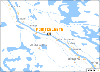
Point Celeste (Louisiana, United States - USA)Point Celeste is a town in the Louisiana region of United States - USA. An overview map of the region around Point Celeste is displayed below.
regional and 3d topo map of Point Celeste, United States - USA ::
Point Celeste airports ::
The nearest airport is NBG - New Orleans Nas Jrb, located 31.0 km north west of Point Celeste.
Other airports nearby include MSY - Louis Armstrong New Orleans Intl (59.1 km north west), BIX - Biloxi Keesler Afb (126.7 km north east), BTR - Baton Rouge Metro Ryan Fld (162.8 km north west), MOB - Mobile Rgnl (196.5 km north east), Nearby towns ::
Davant (1.1km north) //
Nero (2.5km north west) //
Woodland (2.7km south east) //
Bellevue (4.7km north west) //
Deer Range (4.8km west) //
Lake Judge Perez (5.7km south west) //
West Pointe A La Hache (5.6km south east) //
Harlem (5.8km north west) //
Pointe a la Hache (6.0km south east) //
Magnolia (8.1km south east) //
Martin (8.2km south east) //
Beshel (8.6km south east) //
[all distances 'as the bird flies' and approximate] 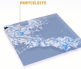 Places with similar names to Point Celeste, United States - USA :: Disclaimer :: Information on this page comes without warranty of any kind |
||
|
Where is Point Celeste? Elevation and coordinates ::
Latitude (lat): 29°35'53"N Longitude (lon): 89°50'53"W
Elevation (approx.): 5m (map arrows pan, magnifying glasses zoom) |
||
|
Visiting Point Celeste? Hotel/Accommodation ::
Book a hotel in Point Celeste Travel Guide ::
rental cars ::
car rental offers GPS waypoint ::
download a GPX waypoint (PoI) of Point Celeste for your GPS receiver
|
||