|
search place name
|
||
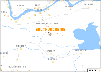
South Vacherie (Louisiana, United States - USA)South Vacherie is a town in the Louisiana region of United States - USA. An overview map of the region around South Vacherie is displayed below.
regional and 3d topo map of South Vacherie, United States - USA ::
South Vacherie airports ::
The nearest airport is MSY - Louis Armstrong New Orleans Intl, located 43.3 km east of South Vacherie.
Other airports nearby include NBG - New Orleans Nas Jrb (65.2 km east), BTR - Baton Rouge Metro Ryan Fld (79.9 km north west), LFT - Lafayette Rgnl (127.9 km west), BIX - Biloxi Keesler Afb (179.2 km east), Nearby towns ::
Lower Vacherie (2.3km north east) //
Webre Steib Plantation (3.6km north) //
Golden Star Plantation (3.6km east) //
Kraemer (6.7km south) //
Southdown Plantation (6.8km north west) //
North Vacherie (7.7km north) //
Armant (8.2km north) //
Miles (9.2km north) //
Saint James Plantation (9.3km north west) //
Oak Alley (9.5km north west) //
Feitel (10.9km north west) //
[all distances 'as the bird flies' and approximate] 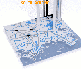 Places with similar names to South Vacherie, United States - USA :: Disclaimer :: Information on this page comes without warranty of any kind |
||
|
Where is South Vacherie? Elevation and coordinates ::
Latitude (lat): 29°55'38"N Longitude (lon): 90°41'59"W
Elevation (approx.): 5m (map arrows pan, magnifying glasses zoom) |
||
|
Visiting South Vacherie? Hotel/Accommodation ::
Book a hotel in South Vacherie Travel Guide ::
rental cars ::
car rental offers GPS waypoint ::
download a GPX waypoint (PoI) of South Vacherie for your GPS receiver
|
||