|
search place name
|
||
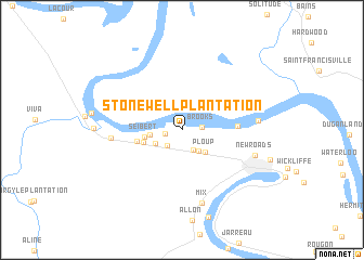
Stonewell Plantation (Louisiana, United States - USA)Stonewell Plantation is a town in the Louisiana region of United States - USA. An overview map of the region around Stonewell Plantation is displayed below.
regional and 3d topo map of Stonewell Plantation, United States - USA ::
Stonewell Plantation airports ::
The nearest airport is BTR - Baton Rouge Metro Ryan Fld, located 40.1 km south east of Stonewell Plantation.
Other airports nearby include LFT - Lafayette Rgnl (74.0 km south west), ESF - Alexandria Esler Rgnl (105.9 km north west), AEX - Alexandria Intl (120.1 km north west), MSY - Louis Armstrong New Orleans Intl (144.7 km south east), Nearby towns ::
Brunswick Plantation (1.5km west) //
Brooks (1.8km east) //
Kelsey (2.1km south west) //
Beaud (2.3km south east) //
Leavel (2.6km south east) //
Morrison (2.8km south west) //
Ploup (3.0km south east) //
Stewart Plantation (2.8km west) //
Seibert (3.4km west) //
Samuels (3.7km west) //
Labarre (4.2km west) //
Shexnayder (5.0km east) //
Dawson Switch (6.4km west) //
Mix (7.8km south) //
Pointe Coupee (6.8km east) //
New Roads (7.0km east) //
[all distances 'as the bird flies' and approximate] 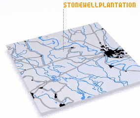 Places with similar names to Stonewell Plantation, United States - USA :: Disclaimer :: Information on this page comes without warranty of any kind |
||
|
Where is Stonewell Plantation? Elevation and coordinates ::
Latitude (lat): 30°43'31"N Longitude (lon): 91°30'14"W
Elevation (approx.): 10m (map arrows pan, magnifying glasses zoom) |
||
|
Visiting Stonewell Plantation? Hotel/Accommodation ::
Book a hotel in Stonewell Plantation Travel Guide ::
rental cars ::
car rental offers GPS waypoint ::
download a GPX waypoint (PoI) of Stonewell Plantation for your GPS receiver
|
||