|
search place name
|
||
Tanglewood (Louisiana, United States - USA)Tanglewood is a town in the Louisiana region of United States - USA. An overview map of the region around Tanglewood is displayed below.
regional and 3d topo map of Tanglewood, United States - USA ::

Tanglewood airports ::
The nearest airport is BTR - Baton Rouge Metro Ryan Fld, located 7.2 km west of Tanglewood.
Other airports nearby include LFT - Lafayette Rgnl (95.2 km south west), MSY - Louis Armstrong New Orleans Intl (99.1 km south east), NBG - New Orleans Nas Jrb (127.6 km south east), ESF - Alexandria Esler Rgnl (150.4 km north west), Nearby towns ::
Carmel Acres (1.0km north west) //
Boganvilla (1.3km north east) //
Winchester (1.4km south west) //
Monhegan (1.5km west) //
Willowood Acres (2.2km north) //
Comite Estates (2.7km south west) //
Comite Hills West (2.9km south east) //
Pecan Ridge (2.8km north west) //
Welcome Heights (3.2km north) //
Morgan Place West (3.0km north east) //
Centerra (3.2km north east) //
Morgan Place (2.9km east) //
Comite Hills (3.3km south east) //
Greenwood (3.1km west) //
Green Acres (3.2km west) //
Brian Estates (4.0km south) //
Lazy Lake Estates (3.6km east) //
Pleasant Hills (3.6km west) //
Whispering Oaks (3.8km north west) //
Puckett (4.3km north east) //
Huntley Place (4.0km east) //
Green Gate (4.1km north west) //
Central (4.1km north east) //
Waters Edge (4.4km north west) //
Woods Edge (4.4km south east) //
Greenwood Estates (4.3km west) //
Jackson Park (4.5km north east) //
Jackson Place (4.6km north east) //
Oak Shadows Place (4.4km south east) //
[all distances 'as the bird flies' and approximate] 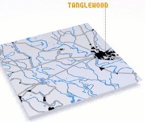 Places with similar names to Tanglewood, United States - USA ::
// Tanglewood (US)
// Dinglewood (US)
// Tanglewood (US)
// Tanglewood (US)
// Tanglewood (US)
// Tanglewood (US)
// Tanglewood (US)
// Tanglewood (US)
// Tanglewood (US)
// Tanglewood (US)
Disclaimer :: Information on this page comes without warranty of any kind |
||
|
Where is Tanglewood? Elevation and coordinates ::
Latitude (lat): 30°32'16"N Longitude (lon): 91°4'30"W
Elevation (approx.): 24m (map arrows pan, magnifying glasses zoom) |
||
|
Visiting Tanglewood? Hotel/Accommodation ::
Book a hotel in Tanglewood Travel Guide ::
rental cars ::
car rental offers GPS waypoint ::
download a GPX waypoint (PoI) of Tanglewood for your GPS receiver
|
||