|
search place name
|
||
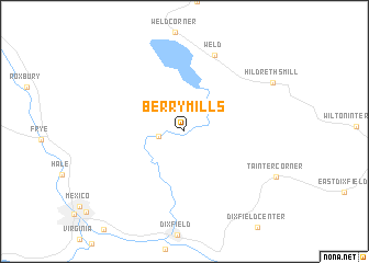
Berry Mills (Maine, United States - USA)Berry Mills is a town in the Maine region of United States - USA. An overview map of the region around Berry Mills is displayed below.
regional and 3d topo map of Berry Mills, United States - USA ::
Berry Mills airports ::
The nearest airport is PWM - Portland Intl Jetport, located 109.8 km south of Berry Mills.
Other airports nearby include BGR - Bangor Intl (130.0 km east), YSC - Sherbrooke (132.9 km north west), Nearby towns ::
 Places with similar names to Berry Mills, United States - USA ::
// Bramales (CU)
// Bramales (CU)
// Bar Mills (US)
// Birem Bollossou (TD)
// Bromeilles (FR)
// Berry Mills (CA)
// Barre Mills (US)
// Bára Malesí (GR)
Disclaimer :: Information on this page comes without warranty of any kind |
||
|
Where is Berry Mills? Elevation and coordinates ::
Latitude (lat): 44°37'45"N Longitude (lon): 70°27'0"W
Elevation (approx.): 156m (map arrows pan, magnifying glasses zoom) |
||
|
Visiting Berry Mills? Hotel/Accommodation ::
Book a hotel in Berry Mills Travel Guide ::
rental cars ::
car rental offers GPS waypoint ::
download a GPX waypoint (PoI) of Berry Mills for your GPS receiver
|
||