|
search place name
|
||
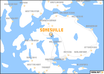
Somesville (Maine, United States - USA)Somesville is a town in the Maine region of United States - USA. An overview map of the region around Somesville is displayed below.
regional and 3d topo map of Somesville, United States - USA ::
Somesville airports ::
The nearest airport is BGR - Bangor Intl, located 63.1 km north west of Somesville.
Other airports nearby include PWM - Portland Intl Jetport (177.2 km south west), YFC - Fredericton (219.2 km north east), Nearby towns ::
Hall Quarry (3.1km south) //
Indian Point (3.1km north west) //
Town Hill (4.0km north) //
Red Rock Corner (4.9km north) //
Pretty Marsh (5.7km south west) //
Eden (7.7km north) //
Asticou (7.7km south east) //
Northeast Harbor (8.4km south east) //
Trenton (9.0km north) //
Salsbury Cove (8.6km north east) //
West Trenton (9.6km north west) //
Seal Cove (9.9km south west) //
[all distances 'as the bird flies' and approximate] 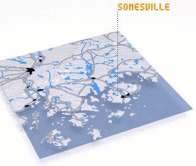 Places with similar names to Somesville, United States - USA ::
// Simmsville (US)
// Simsville (US)
// Simsville (US)
// Simsville (US)
// Samsville (US)
// Sams Valley (US)
// Seemsville (US)
// Saumsville (US)
// Simsville (AU)
Disclaimer :: Information on this page comes without warranty of any kind |
||
|
Where is Somesville? Elevation and coordinates ::
Latitude (lat): 44°21'44"N Longitude (lon): 68°20'5"W
Elevation (approx.): 12m (map arrows pan, magnifying glasses zoom) |
||
|
Visiting Somesville? Hotel/Accommodation ::
Book a hotel in Somesville Travel Guide ::
rental cars ::
car rental offers GPS waypoint ::
download a GPX waypoint (PoI) of Somesville for your GPS receiver
|
||