|
search place name
|
||
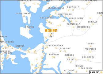
Baker (Maryland, United States - USA)Baker is a town in the Maryland region of United States - USA. An overview map of the region around Baker is displayed below.
regional and 3d topo map of Baker, United States - USA ::
Baker airports ::
The nearest airport is BWI - Baltimore Washington Intl, located 49.4 km west of Baker.
Other airports nearby include APG - Aberdeen Phillips Aaf (51.0 km north), DOV - Dover Afb (59.8 km east), ADW - Camp Springs Andrews Afb (Washington Dc Naf) (66.8 km west), DCA - Ronald Reagan Washington Natl (79.8 km west), Nearby towns ::
Blakeford (1.5km west) //
White Banks (1.7km west) //
Queenstown (2.5km south west) //
Mainbrace (3.8km south) //
Bloomingdale (4.1km south) //
River Bend Estates (4.0km south west) //
Hickory Ridge (4.3km south west) //
Hunters Ridge (4.7km north east) //
Recovery (5.1km north) //
Brownsville (5.0km north east) //
Bulle Rock (5.5km north) //
Wye Harbor (5.4km south west) //
Queenstown Mobile Home Park (5.7km south east) //
Mallard Point (6.2km north) //
Governor Grayson Manor (6.2km south) //
Wye River Farms (6.7km south) //
Scottown (6.4km south east) //
Overlook (7.2km south) //
Carmichael (7.3km south) //
Woodstream (6.8km north east) //
Pioneer Point Farms (7.6km north) //
Earle Landing (7.8km north) //
Earles Branch (7.2km north east) //
Winchester Estates (6.9km south west) //
Belle Point Farm (7.7km south) //
Bryantown (7.8km south) //
Corsica Landing (7.9km north) //
Fisher Manor (7.4km south west) //
White House Acres (7.3km south west) //
[all distances 'as the bird flies' and approximate] 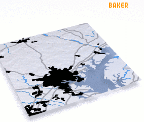 Places with similar names to Baker, United States - USA ::
Disclaimer :: Information on this page comes without warranty of any kind |
||
|
Where is Baker? Elevation and coordinates ::
Latitude (lat): 39°0'28"N Longitude (lon): 76°8'20"W
Elevation (approx.): 16m (map arrows pan, magnifying glasses zoom) |
||
|
Visiting Baker? Hotel/Accommodation ::
Book a hotel in Baker Travel Guide ::
rental cars ::
car rental offers GPS waypoint ::
download a GPX waypoint (PoI) of Baker for your GPS receiver
|
||