|
search place name
|
||
Ballenger Heights (Maryland, United States - USA)Ballenger Heights is a town in the Maryland region of United States - USA. An overview map of the region around Ballenger Heights is displayed below.
regional and 3d topo map of Ballenger Heights, United States - USA ::

Ballenger Heights airports ::
The nearest airport is IAD - Washington Dulles Intl, located 46.5 km south of Ballenger Heights.
Other airports nearby include DCA - Ronald Reagan Washington Natl (69.3 km south east), BWI - Baltimore Washington Intl (74.7 km east), ADW - Camp Springs Andrews Afb (Washington Dc Naf) (82.1 km south east), MDT - Harrisburg Intl (111.8 km north east), Nearby towns ::
Concord (0.8km north) //
Mulberry Tree Acres (1.3km south east) //
Brentwood (2.0km north) //
Renn Branch Estates (1.7km north east) //
Mar-Lu-Ridge Vista (2.1km south) //
Wye Creek (2.4km north east) //
Jefferson Heights (2.2km south west) //
Catoctin Point (2.2km west) //
Glenridge Estates (2.5km north west) //
Hillside Estates (2.7km north) //
Mountville (2.5km south west) //
Mount Zion Estates (2.8km north) //
Kings Kingdom (2.6km north east) //
Mount Zion Knolls (3.1km north) //
Mathews (2.6km north east) //
Windsor Estates (2.6km south east) //
Skyline Estates (3.1km north) //
Horman (3.3km north) //
Poplar Thicket (3.2km south) //
Church Hill (2.9km south east) //
West Frederick Highlands (2.7km east) //
Jefferson (2.8km west) //
Feagaville (3.4km north east) //
Make Shift Estates (3.3km north east) //
Skyline Gardens (3.9km north) //
Sunset View (3.9km north) //
Briercrest Heights (3.1km west) //
Strawleigh (4.2km north) //
Holter (4.3km north) //
[all distances 'as the bird flies' and approximate] 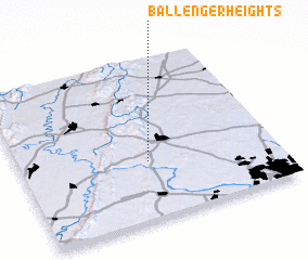 Places with similar names to Ballenger Heights, United States - USA ::
// Bollinger Heights (US)
Disclaimer :: Information on this page comes without warranty of any kind |
||
|
Where is Ballenger Heights? Elevation and coordinates ::
Latitude (lat): 39°21'42"N Longitude (lon): 77°29'59"W
Elevation (approx.): 148m (map arrows pan, magnifying glasses zoom) |
||
|
Visiting Ballenger Heights? Hotel/Accommodation ::
Book a hotel in Ballenger Heights Travel Guide ::
rental cars ::
car rental offers GPS waypoint ::
download a GPX waypoint (PoI) of Ballenger Heights for your GPS receiver
|
||