|
search place name
|
||
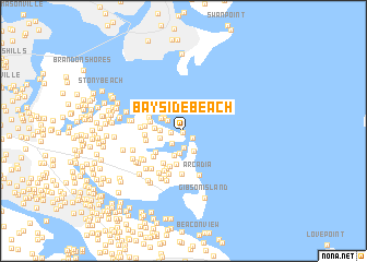
Bayside Beach (Maryland, United States - USA)Bayside Beach is a town in the Maryland region of United States - USA. An overview map of the region around Bayside Beach is displayed below.
regional and 3d topo map of Bayside Beach, United States - USA ::
Bayside Beach airports ::
The nearest airport is BWI - Baltimore Washington Intl, located 19.9 km west of Bayside Beach.
Other airports nearby include APG - Aberdeen Phillips Aaf (43.6 km north east), ADW - Camp Springs Andrews Afb (Washington Dc Naf) (51.5 km south west), DCA - Ronald Reagan Washington Natl (60.4 km south west), DOV - Dover Afb (84.5 km east), Nearby towns ::
Hickory Point (0.1km south) //
Pinehurst Harbour (1.0km south east) //
Bodkin Manor (1.0km west) //
Pinehurst on the Bodkin (1.7km south) //
Ventnor (1.6km south west) //
Pasadena Beach (1.6km north west) //
Maryland Beach (1.9km north west) //
Green Gables (2.3km south) //
Pinehurst (2.3km south) //
Pine Crest North (1.9km west) //
Poplar Ridge (2.0km west) //
Kurtz Beach (2.1km north west) //
Paradise Beach (2.2km north west) //
Ventnor Forest (2.6km south) //
Springdale (2.3km west) //
Hampton Chase (2.8km west) //
Milburn on the Magothy (3.5km south) //
Windermere Estates (3.0km south west) //
Chase Wood Run (3.1km north west) //
Long Point on the Magothy (3.8km south) //
Mount Carmel (3.7km south west) //
Alloway (3.1km west) //
Belhaven Beach (3.1km west) //
Pine Crest West (3.1km west) //
Saybrooke (3.6km south west) //
Kingston Estates (4.0km south) //
Long Point (4.4km south) //
Belhaven Woods (3.5km west) //
Venice on the Bay (3.7km north west) //
[all distances 'as the bird flies' and approximate]  Places with similar names to Bayside Beach, United States - USA ::
// Bayside Beach (US)
// Bayside Beach (US)
Disclaimer :: Information on this page comes without warranty of any kind |
||
|
Where is Bayside Beach? Elevation and coordinates ::
Latitude (lat): 39°8'11"N Longitude (lon): 76°26'37"W
Elevation (approx.): 2m (map arrows pan, magnifying glasses zoom) |
||
|
Visiting Bayside Beach? Hotel/Accommodation ::
Book a hotel in Bayside Beach Travel Guide ::
rental cars ::
car rental offers GPS waypoint ::
download a GPX waypoint (PoI) of Bayside Beach for your GPS receiver
|
||