|
search place name
|
||
Bush (Maryland, United States - USA)Bush is a town in the Maryland region of United States - USA. An overview map of the region around Bush is displayed below.
regional and 3d topo map of Bush, United States - USA ::

Bush airports ::
The nearest airport is APG - Aberdeen Phillips Aaf, located 8.3 km east of Bush.
Other airports nearby include BWI - Baltimore Washington Intl (48.1 km south west), ILG - Wilmington New Castle (60.9 km east), DOV - Dover Afb (78.8 km south east), ADW - Camp Springs Andrews Afb (Washington Dc Naf) (90.2 km south west), Nearby towns ::
Royal Heights (0.8km west) //
Philadelphia Station (0.9km south west) //
Village of Church Creek (0.9km north east) //
Beechwood Mobile Home Park (1.2km south) //
Mount Bush Estates (1.3km south) //
Bynum Overlook (1.3km north west) //
Village of Bynum Run (1.4km west) //
Bynum Hills (1.8km north west) //
Abingdon (1.8km south west) //
Pembrook (2.2km north) //
Abingdon Reserve (1.8km south west) //
Harford Furnace (2.4km north) //
Henley Park (2.1km north east) //
Riverside (2.0km east) //
Long Bar Harbor (2.4km south east) //
Wildwood (2.4km south east) //
Lou Mar Estates (2.1km west) //
Woodland Run (2.2km west) //
Osborns Ruins (2.5km south west) //
Riverside Village of Church Creek (2.5km east) //
Bradford Barrens (2.6km west) //
Belcamp (2.7km east) //
Norris Corner (2.8km west) //
Box Hill South (2.9km west) //
The Cedars (3.0km west) //
White Oak Crest (2.9km west) //
Rivershore (3.8km south) //
Creswell (3.8km north) //
Bay View Mobile Home Park (3.6km south west) //
[all distances 'as the bird flies' and approximate] 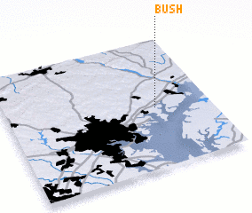 Places with similar names to Bush, United States - USA ::
Disclaimer :: Information on this page comes without warranty of any kind |
||
|
Where is Bush? Elevation and coordinates ::
Latitude (lat): 39°28'25"N Longitude (lon): 76°15'52"W
Elevation (approx.): 8m (map arrows pan, magnifying glasses zoom) |
||
|
Visiting Bush? Hotel/Accommodation ::
Book a hotel in Bush Travel Guide ::
rental cars ::
car rental offers GPS waypoint ::
download a GPX waypoint (PoI) of Bush for your GPS receiver
|
||