|
search place name
|
||
Cedarhaven (Maryland, United States - USA)Cedarhaven is a town in the Maryland region of United States - USA. An overview map of the region around Cedarhaven is displayed below.
regional and 3d topo map of Cedarhaven, United States - USA ::

Cedarhaven airports ::
The nearest airport is ADW - Camp Springs Andrews Afb (Washington Dc Naf), located 30.7 km north west of Cedarhaven.
Other airports nearby include NHK - Patuxent River Nas (39.9 km south east), DCA - Ronald Reagan Washington Natl (43.5 km north west), BWI - Baltimore Washington Intl (66.9 km north), IAD - Washington Dulles Intl (78.6 km north west), Nearby towns ::
Eagle Harbor (0.6km south) //
Potts Point (2.0km south east) //
Abington Shores (2.1km north east) //
Deep Landing Estates (2.4km north east) //
Deep Landing (3.0km north east) //
Wild Goose Landing (2.7km east) //
New Enterprise (3.3km north east) //
Quail Ridge (3.5km east) //
Aquasco (3.6km west) //
Lowery Oaks (3.6km east) //
Holland Cliff Shores (4.3km north east) //
The Oaks (4.3km north east) //
Woodland Acres (4.3km north east) //
Teagues Point (4.8km south west) //
Fiddlers Point (4.3km east) //
Fox Den (5.2km north east) //
Holland Glenn (5.2km north east) //
Swanson Creek Landing (5.0km south west) //
Maxwell Hall (5.9km south) //
Shady Hill Farm (5.7km north east) //
Cox (5.1km north east) //
Meadow Woods Estates (5.1km north west) //
Cedar Point (4.9km east) //
Buena Vista (5.8km south east) //
Buena Vista on the Patuxent (6.0km south east) //
Hunting Lake (5.4km north east) //
Westfield Station (5.3km east) //
Milltown Landing (6.7km north) //
The Alameda (5.6km north east) //
[all distances 'as the bird flies' and approximate] 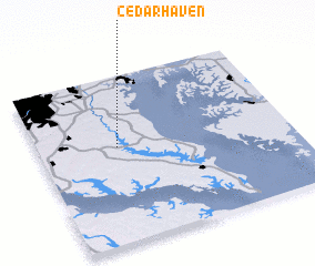 Places with similar names to Cedarhaven, United States - USA ::
// Süderhafen (DE)
// Cedar Haven (US)
Disclaimer :: Information on this page comes without warranty of any kind |
||
|
Where is Cedarhaven? Elevation and coordinates ::
Latitude (lat): 38°34'22"N Longitude (lon): 76°41'11"W
Elevation (approx.): 8m (map arrows pan, magnifying glasses zoom) |
||
|
Visiting Cedarhaven? Hotel/Accommodation ::
Book a hotel in Cedarhaven Travel Guide ::
rental cars ::
car rental offers GPS waypoint ::
download a GPX waypoint (PoI) of Cedarhaven for your GPS receiver
|
||