|
search place name
|
||
Chapel Ridge (Maryland, United States - USA)Chapel Ridge is a town in the Maryland region of United States - USA. An overview map of the region around Chapel Ridge is displayed below.
regional and 3d topo map of Chapel Ridge, United States - USA ::

Chapel Ridge airports ::
The nearest airport is BWI - Baltimore Washington Intl, located 30.1 km south of Chapel Ridge.
Other airports nearby include APG - Aberdeen Phillips Aaf (43.1 km east), ADW - Camp Springs Andrews Afb (Washington Dc Naf) (72.6 km south), DCA - Ronald Reagan Washington Natl (73.3 km south west), MDT - Harrisburg Intl (83.3 km north), Nearby towns ::
Chapelgate (0.8km north east) //
Fallswood (0.9km west) //
Brierleigh (1.2km south) //
Chapel Hill (1.2km south east) //
Mays Chapel Village (1.1km east) //
The Hill Farm (1.3km south west) //
Woodward (1.5km south) //
Deer Run (1.5km south) //
The Oaks at Five Farms (1.3km east) //
Westwind (1.5km south east) //
Mays Chapel North (1.5km north east) //
Mayfair (1.4km east) //
Boxer Hill Park (1.7km north west) //
Hillside Hunt (1.9km north west) //
Cooperfield (2.0km south east) //
Huntspring (2.2km south) //
Laurelford (2.3km north) //
Hillside at Seminary (2.3km south east) //
Mays Chapel (2.2km south east) //
Seminary Springs (2.6km south) //
Brooklandwood Estates (2.6km south) //
Seminary Overlook (2.5km south east) //
Brooklandville (2.9km south) //
Valleywood (2.3km east) //
Boxwood (2.9km south east) //
Ridgemont (2.4km west) //
Texas (2.9km north east) //
Wellington Valley (2.9km south east) //
Hickory Meadow (2.8km north west) //
[all distances 'as the bird flies' and approximate] 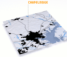 Places with similar names to Chapel Ridge, United States - USA ::
// Shipley Ridge (US)
// Chapel Ridge (US)
Disclaimer :: Information on this page comes without warranty of any kind |
||
|
Where is Chapel Ridge? Elevation and coordinates ::
Latitude (lat): 39°26'47"N Longitude (lon): 76°40'7"W
Elevation (approx.): 181m (map arrows pan, magnifying glasses zoom) |
||
|
Visiting Chapel Ridge? Hotel/Accommodation ::
Book a hotel in Chapel Ridge Travel Guide ::
rental cars ::
car rental offers GPS waypoint ::
download a GPX waypoint (PoI) of Chapel Ridge for your GPS receiver
|
||