|
search place name
|
||
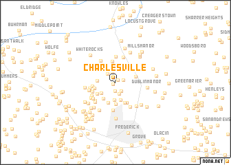
Charlesville (Maryland, United States - USA)Charlesville is a town in the Maryland region of United States - USA. An overview map of the region around Charlesville is displayed below.
regional and 3d topo map of Charlesville, United States - USA ::
Charlesville airports ::
The nearest airport is IAD - Washington Dulles Intl, located 60.4 km south of Charlesville.
Other airports nearby include BWI - Baltimore Washington Intl (74.3 km south east), DCA - Ronald Reagan Washington Natl (78.3 km south east), ADW - Camp Springs Andrews Afb (Washington Dc Naf) (89.5 km south east), MDT - Harrisburg Intl (96.9 km north east), Nearby towns ::
Ford Road Acres (0.4km south west) //
Sundays Manor (0.5km north east) //
Catoctin Manor Estates (1.0km east) //
Amelano Manor (1.4km south) //
Bloomfield (1.6km south east) //
Willis Acres (1.7km north) //
Bethel (1.7km north west) //
Meadowbrook (2.0km south) //
Heatherview (2.3km north) //
Tuscarora Springs (2.3km north west) //
Cloverdale (2.8km south) //
Winpenny Tell (2.4km south west) //
White Rock (2.3km west) //
Cloverview (2.9km south) //
Indian Springs (3.0km south west) //
Hansonville (2.7km east) //
Williar (3.0km north east) //
Larvadale Estates (3.4km north) //
White Flint Springs (2.9km south west) //
Christophers Crossing (3.4km south) //
Yellow Springs (2.8km west) //
Clover Hill (3.6km south) //
Harmony Hill (3.1km north east) //
Bartlett Heights (3.5km south) //
Woods (2.9km west) //
Arrowhead (3.6km south east) //
Lawrence (3.2km south west) //
Ziegler Estates (4.2km north) //
Mountaindale (3.9km north west) //
[all distances 'as the bird flies' and approximate] 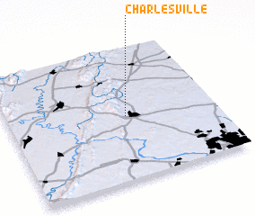 Places with similar names to Charlesville, United States - USA ::
// Charlesville (ZA)
// Charlesville (US)
// Charlesville (US)
// Charlesville (LR)
// Charlesville (4) (LR)
Disclaimer :: Information on this page comes without warranty of any kind |
||
|
Where is Charlesville? Elevation and coordinates ::
Latitude (lat): 39°29'17"N Longitude (lon): 77°25'47"W
Elevation (approx.): 124m (map arrows pan, magnifying glasses zoom) |
||
|
Visiting Charlesville? Hotel/Accommodation ::
Book a hotel in Charlesville Travel Guide ::
rental cars ::
car rental offers GPS waypoint ::
download a GPX waypoint (PoI) of Charlesville for your GPS receiver
|
||