|
search place name
|
||
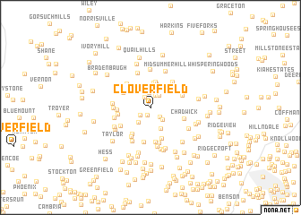
Clover Field (Maryland, United States - USA)Clover Field is a town in the Maryland region of United States - USA. An overview map of the region around Clover Field is displayed below.
regional and 3d topo map of Clover Field, United States - USA ::
Clover Field airports ::
The nearest airport is APG - Aberdeen Phillips Aaf, located 31.0 km south east of Clover Field.
Other airports nearby include BWI - Baltimore Washington Intl (51.4 km south), MDT - Harrisburg Intl (69.0 km north), ILG - Wilmington New Castle (74.9 km east), MUI - Muir Aaf (91.6 km north), Nearby towns ::
Jarrettsville (1.0km south) //
Hoerr (1.4km north west) //
Federal Hill Heights (1.6km north) //
Harford Downs (1.4km south west) //
Dulaney Ridge (1.5km south east) //
North Harford Heights (1.7km north east) //
Harford Heritage (1.9km north) //
Advocate Hill Farms (1.9km south east) //
Green Valley (2.2km south west) //
Spooners Creek (2.4km north) //
North Bend Heights (2.3km north east) //
Jarrettswood (2.8km south) //
Meadowlark Estates (3.0km north) //
Federal Hill (3.1km north) //
Spring Meadows (3.0km north east) //
Twin Ridge Estates (3.2km north) //
Madonna Manor (3.2km north west) //
Furnace (3.8km south west) //
Steeplechase Manor (3.9km south) //
Rolling Knolls (3.7km north west) //
Hunt Crest (3.2km west) //
Cool Meadows Farms (3.3km west) //
Northampton (3.8km north east) //
Rush Manor (3.4km north east) //
Hy-Crest (4.3km south) //
Quiet Inheritance (4.0km south west) //
Greenfields (4.3km south) //
Fox Meadows (3.7km south west) //
Chadwick (3.5km south east) //
[all distances 'as the bird flies' and approximate] 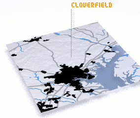 Places with similar names to Clover Field, United States - USA ::
// Cloverfield (US)
// Clover Flat (US)
Disclaimer :: Information on this page comes without warranty of any kind |
||
|
Where is Clover Field? Elevation and coordinates ::
Latitude (lat): 39°36'48"N Longitude (lon): 76°28'30"W
Elevation (approx.): 199m (map arrows pan, magnifying glasses zoom) |
||
|
Visiting Clover Field? Hotel/Accommodation ::
Book a hotel in Clover Field Travel Guide ::
rental cars ::
car rental offers GPS waypoint ::
download a GPX waypoint (PoI) of Clover Field for your GPS receiver
|
||