|
search place name
|
||
Defense Heights (Maryland, United States - USA)Defense Heights is a town in the Maryland region of United States - USA. An overview map of the region around Defense Heights is displayed below.
regional and 3d topo map of Defense Heights, United States - USA ::

Defense Heights airports ::
The nearest airport is BWI - Baltimore Washington Intl, located 19.0 km south west of Defense Heights.
Other airports nearby include APG - Aberdeen Phillips Aaf (35.1 km north east), ADW - Camp Springs Andrews Afb (Washington Dc Naf) (62.1 km south west), DCA - Ronald Reagan Washington Natl (67.1 km south west), ILG - Wilmington New Castle (88.8 km north east), Nearby towns ::
Colgate (0.3km south west) //
Stab (0.7km south west) //
Liberty Trailer Park (0.9km east) //
Eastpoint (1.5km south) //
Rosedale Terrace (1.8km north) //
Harborview (2.0km south west) //
Back River (1.8km east) //
Rosedale (2.5km north) //
Hudson Heights (2.2km south west) //
Chesaco Park (2.3km north east) //
Graceland (2.6km south west) //
Hamilton (2.8km north) //
Norwood Park (2.9km south) //
Gray Manor (2.8km south east) //
Bluegrass Heights (3.1km north) //
Eastern Terrace (2.6km north east) //
Brooks Hill (3.2km south west) //
Hillbrook (3.5km north) //
Berkfield (3.7km north) //
Garden Village Park (3.7km north) //
Eastfield (3.9km south) //
O'Donnell Heights (3.4km south west) //
Lutz Hill (3.9km north) //
Grange (3.9km south) //
Armistead Gardens (3.1km west) //
Orangeville (3.1km west) //
Weyburn Park (4.0km north) //
Back River Highlands (3.4km north east) //
Stanbrook (4.1km south) //
[all distances 'as the bird flies' and approximate] 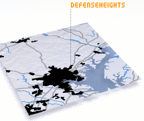 Places with similar names to Defense Heights, United States - USA ::
// Defense Heights (US)
Disclaimer :: Information on this page comes without warranty of any kind |
||
|
Where is Defense Heights? Elevation and coordinates ::
Latitude (lat): 39°17'52"N Longitude (lon): 76°30'50"W
Elevation (approx.): 24m (map arrows pan, magnifying glasses zoom) |
||
|
Visiting Defense Heights? Hotel/Accommodation ::
Book a hotel in Defense Heights Travel Guide ::
rental cars ::
car rental offers GPS waypoint ::
download a GPX waypoint (PoI) of Defense Heights for your GPS receiver
|
||