|
search place name
|
||
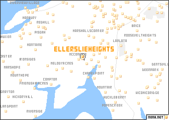
Ellerslie Heights (Maryland, United States - USA)Ellerslie Heights is a town in the Maryland region of United States - USA. An overview map of the region around Ellerslie Heights is displayed below.
regional and 3d topo map of Ellerslie Heights, United States - USA ::
Ellerslie Heights airports ::
The nearest airport is ADW - Camp Springs Andrews Afb (Washington Dc Naf), located 37.9 km north east of Ellerslie Heights.
Other airports nearby include DCA - Ronald Reagan Washington Natl (39.1 km north), NHK - Patuxent River Nas (60.5 km south east), IAD - Washington Dulles Intl (60.7 km north west), BWI - Baltimore Washington Intl (81.9 km north east), Nearby towns ::
Port Tobacco Hills (0.5km north west) //
Penn Manor (0.9km south east) //
McConchie (1.1km west) //
Port Tobacco Lakes (1.2km east) //
Port Tobacco Riviera (2.0km north east) //
Simms Landing (2.3km south east) //
Sutton Acres (2.5km east) //
Potomac Shores (2.9km south east) //
Port Tobacco (3.0km north east) //
Cedar Grove (3.4km south west) //
Graystone Estates (3.3km north west) //
Brentland (3.9km south) //
Chapel Point (4.4km south) //
Highland Estates (3.7km east) //
Melody Acres (4.2km south west) //
Hawthorne Manor (4.7km north east) //
Caernarvon Woods (5.3km north) //
Marshalls Corner (5.5km north) //
Ripley (5.6km north west) //
Hawthorne (5.5km north east) //
Nelson (5.6km north west) //
Morgans Ridge (5.3km north east) //
Preference Estates (5.0km east) //
Valley View (5.5km north east) //
Rolling Hills (5.3km south east) //
Welcome Acres (5.4km south west) //
Garden Estates (5.5km north west) //
Chapel Point Woods (5.9km south east) //
Springhill (5.5km east) //
[all distances 'as the bird flies' and approximate]  Places with similar names to Ellerslie Heights, United States - USA :: Disclaimer :: Information on this page comes without warranty of any kind |
||
|
Where is Ellerslie Heights? Elevation and coordinates ::
Latitude (lat): 38°30'1"N Longitude (lon): 77°2'54"W
Elevation (approx.): 58m (map arrows pan, magnifying glasses zoom) |
||
|
Visiting Ellerslie Heights? Hotel/Accommodation ::
Book a hotel in Ellerslie Heights Travel Guide ::
rental cars ::
car rental offers GPS waypoint ::
download a GPX waypoint (PoI) of Ellerslie Heights for your GPS receiver
|
||