|
search place name
|
||
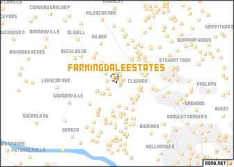
Farmingdale Estates (Maryland, United States - USA)Farmingdale Estates is a town in the Maryland region of United States - USA. An overview map of the region around Farmingdale Estates is displayed below.
regional and 3d topo map of Farmingdale Estates, United States - USA ::
Farmingdale Estates airports ::
The nearest airport is IAD - Washington Dulles Intl, located 28.2 km south west of Farmingdale Estates.
Other airports nearby include DCA - Ronald Reagan Washington Natl (39.5 km south east), ADW - Camp Springs Andrews Afb (Washington Dc Naf) (52.1 km south east), BWI - Baltimore Washington Intl (52.5 km east), APG - Aberdeen Phillips Aaf (101.4 km east), Nearby towns ::
Pleasant Fields (0.4km south east) //
Williamsburg Square (0.5km east) //
Stoneridge (0.7km north east) //
Old Germantown (0.9km north west) //
Germantown Park (1.1km north east) //
Germantown View (1.3km north) //
Kingsview Knolls (1.3km west) //
Cedar Creek Estates (1.4km south west) //
Liberty Heights (1.7km north) //
Germantown (1.9km north) //
Brownstown Estates (1.9km south west) //
North Germantown (2.3km north) //
Germantown Estates (2.2km north west) //
Brownstown (2.4km south west) //
The Colony (2.7km north east) //
Blackrock Estates (2.6km south west) //
Quince Orchard Valley (2.9km south east) //
Blackrock Hills (2.7km south west) //
Clopper (2.8km east) //
Ancient Oak North (3.7km south) //
Parkridge (3.0km east) //
Relda Square (3.3km south east) //
Quince Orchard Manor (3.6km south east) //
Parkridge Estates (3.1km east) //
Longdraft (3.3km south east) //
Fernshire Woods (3.5km south east) //
Black Hill (3.9km north west) //
Willow Ridge (4.1km south) //
Fox Chapel (3.5km north east) //
[all distances 'as the bird flies' and approximate]  Places with similar names to Farmingdale Estates, United States - USA :: Disclaimer :: Information on this page comes without warranty of any kind |
||
|
Where is Farmingdale Estates? Elevation and coordinates ::
Latitude (lat): 39°9'21"N Longitude (lon): 77°16'30"W
Elevation (approx.): 119m (map arrows pan, magnifying glasses zoom) |
||
|
Visiting Farmingdale Estates? Hotel/Accommodation ::
Book a hotel in Farmingdale Estates Travel Guide ::
rental cars ::
car rental offers GPS waypoint ::
download a GPX waypoint (PoI) of Farmingdale Estates for your GPS receiver
|
||