|
search place name
|
||
Hidden Creek (Maryland, United States - USA)Hidden Creek is a town in the Maryland region of United States - USA. An overview map of the region around Hidden Creek is displayed below.
regional and 3d topo map of Hidden Creek, United States - USA ::

Hidden Creek airports ::
The nearest airport is BWI - Baltimore Washington Intl, located 63.2 km south east of Hidden Creek.
Other airports nearby include IAD - Washington Dulles Intl (71.2 km south), DCA - Ronald Reagan Washington Natl (79.8 km south), MDT - Harrisburg Intl (80.4 km north east), ADW - Camp Springs Andrews Afb (Washington Dc Naf) (88.1 km south), Nearby towns ::
Bunker Hill Estates (0.6km west) //
Bethel (1.4km north) //
Harmon Haven (1.4km north east) //
Rabbit Run (1.8km north east) //
Simpsons Mill (3.2km north) //
Johnsville (3.1km south west) //
Stone Manor (2.8km west) //
Grossnickle (3.5km south west) //
Middleburg (4.0km north) //
Union Bridge (3.3km north east) //
Feesersburg (4.1km north) //
Mounts Scenic Acres (4.1km south west) //
Lovejoy Estates (4.4km south) //
Walden Farms (4.6km north) //
West View Terrace (4.0km north east) //
Coppermine Estates (5.0km south west) //
Fairhaven (4.3km south west) //
Keymar (5.1km north west) //
Clemsonville (4.9km south east) //
Sidmar (4.4km west) //
Wolfs Den (4.7km west) //
Mort Hills (5.1km south west) //
Ladiesburg (5.0km north west) //
Bruceville (6.1km north) //
McKinstrys Mill (5.2km south east) //
Crouse Mill (6.6km north) //
Lamberts Acres (5.5km west) //
Glenn Hill (5.8km north east) //
Oldfield (7.0km south) //
[all distances 'as the bird flies' and approximate] 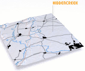 Places with similar names to Hidden Creek, United States - USA ::
Disclaimer :: Information on this page comes without warranty of any kind |
||
|
Where is Hidden Creek? Elevation and coordinates ::
Latitude (lat): 39°33'27"N Longitude (lon): 77°12'45"W
Elevation (approx.): 136m (map arrows pan, magnifying glasses zoom) |
||
|
Visiting Hidden Creek? Hotel/Accommodation ::
Book a hotel in Hidden Creek Travel Guide ::
rental cars ::
car rental offers GPS waypoint ::
download a GPX waypoint (PoI) of Hidden Creek for your GPS receiver
|
||