|
search place name
|
||
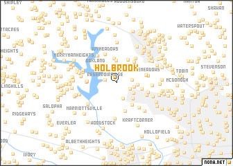
Holbrook (Maryland, United States - USA)Holbrook is a town in the Maryland region of United States - USA. An overview map of the region around Holbrook is displayed below.
regional and 3d topo map of Holbrook, United States - USA ::
Holbrook airports ::
The nearest airport is BWI - Baltimore Washington Intl, located 29.1 km south east of Holbrook.
Other airports nearby include APG - Aberdeen Phillips Aaf (59.4 km east), DCA - Ronald Reagan Washington Natl (62.3 km south), ADW - Camp Springs Andrews Afb (Washington Dc Naf) (64.8 km south), IAD - Washington Dulles Intl (72.2 km south west), Nearby towns ::
Reservoir Ridge (1.5km west) //
Harrisonville (1.9km south east) //
Deer Park (2.0km east) //
Hernwood (2.7km south) //
Twelve Trees (2.3km east) //
Hernwood Heights (2.7km south east) //
Rolling Ridge (2.7km east) //
Kings Park (3.2km south east) //
Tyler (3.7km north) //
Deer Cross (4.0km north) //
Hickory Hill Estates (4.0km north) //
Woodlands (3.3km east) //
Offutt Ridge (4.0km south east) //
Oakland (3.8km north west) //
Delight Meadows (4.0km north east) //
Shervettes Corner (3.7km west) //
Fields of Harvest (4.7km south) //
The Meadows (3.9km east) //
Branton Manor (3.8km west) //
Ivy Meadows (4.8km north) //
Sunnybrook Farms (4.7km north east) //
McDonogh Manor (4.2km south east) //
Silverbrook Farm (4.1km east) //
Mardella Run (4.8km south east) //
Wildwoods (4.3km east) //
Folly Farms (5.0km north west) //
Prospect Hills (4.9km south west) //
Haight (4.6km west) //
Granite (5.7km south) //
[all distances 'as the bird flies' and approximate] 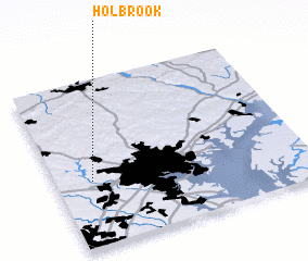 Places with similar names to Holbrook, United States - USA ::
Disclaimer :: Information on this page comes without warranty of any kind |
||
|
Where is Holbrook? Elevation and coordinates ::
Latitude (lat): 39°23'40"N Longitude (lon): 76°51'11"W
Elevation (approx.): 185m (map arrows pan, magnifying glasses zoom) |
||
|
Visiting Holbrook? Hotel/Accommodation ::
Book a hotel in Holbrook Travel Guide ::
rental cars ::
car rental offers GPS waypoint ::
download a GPX waypoint (PoI) of Holbrook for your GPS receiver
|
||