|
search place name
|
||
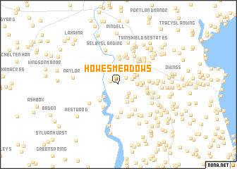
Howes Meadows (Maryland, United States - USA)Howes Meadows is a town in the Maryland region of United States - USA. An overview map of the region around Howes Meadows is displayed below.
regional and 3d topo map of Howes Meadows, United States - USA ::
Howes Meadows airports ::
The nearest airport is ADW - Camp Springs Andrews Afb (Washington Dc Naf), located 20.1 km north west of Howes Meadows.
Other airports nearby include DCA - Ronald Reagan Washington Natl (35.2 km north west), NHK - Patuxent River Nas (51.9 km south east), BWI - Baltimore Washington Intl (52.5 km north), IAD - Washington Dulles Intl (72.4 km west), Nearby towns ::
Patuxent Highland (1.1km north west) //
Smithville (1.4km north east) //
Chaneyville Farm Estates (1.8km south east) //
Ferry Landing Woods (2.2km north) //
Halls Hills (1.9km north east) //
Lord Calvert Estates (2.2km south east) //
Laurian (2.3km north east) //
Dunkirk South (2.3km north east) //
Wards Meadow (2.3km east) //
Bowling Landing (2.7km south west) //
Foxchase (2.9km south) //
Dunkirk (2.8km north east) //
Dunkirk Town Center (2.8km north east) //
Penwick Village (2.8km north east) //
Hampton Heights (2.9km south east) //
Apple Greene (2.8km north east) //
South Hampton (3.1km south east) //
Century Estates (2.8km east) //
Circles Trailer Park (2.9km east) //
Brooks View (3.4km south west) //
Dunkirk Hall (3.0km east) //
Shores of Calvert (4.0km north) //
White Landing (4.1km south west) //
Patuxent Palisades (4.4km north) //
Lower Marlboro Towne (4.4km south) //
Ashwood Manor (4.4km north) //
Regal Estastes (4.5km north) //
MacDonald Farms (3.6km east) //
Chaneyville (3.7km east) //
[all distances 'as the bird flies' and approximate] 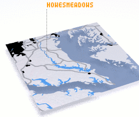 Places with similar names to Howes Meadows, United States - USA :: Disclaimer :: Information on this page comes without warranty of any kind |
||
|
Where is Howes Meadows? Elevation and coordinates ::
Latitude (lat): 38°42'9"N Longitude (lon): 76°40'52"W
Elevation (approx.): 31m (map arrows pan, magnifying glasses zoom) |
||
|
Visiting Howes Meadows? Hotel/Accommodation ::
Book a hotel in Howes Meadows Travel Guide ::
rental cars ::
car rental offers GPS waypoint ::
download a GPX waypoint (PoI) of Howes Meadows for your GPS receiver
|
||