|
search place name
|
||
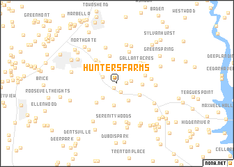
Hunters Farms (Maryland, United States - USA)Hunters Farms is a town in the Maryland region of United States - USA. An overview map of the region around Hunters Farms is displayed below.
regional and 3d topo map of Hunters Farms, United States - USA ::
Hunters Farms airports ::
The nearest airport is ADW - Camp Springs Andrews Afb (Washington Dc Naf), located 27.8 km north of Hunters Farms.
Other airports nearby include DCA - Ronald Reagan Washington Natl (36.7 km north west), NHK - Patuxent River Nas (48.1 km south east), IAD - Washington Dulles Intl (68.6 km north west), BWI - Baltimore Washington Intl (69.8 km north), Nearby towns ::
Bryantown (0.8km south west) //
Briar Ridge (1.2km east) //
Edelen Estates (1.5km south) //
Sandy Level Estates (1.8km east) //
Zekiah Valley (2.1km north west) //
Bryantown Hills (2.9km south west) //
Ridgeview (3.1km south east) //
Kindy Hook (3.6km south) //
Bryantown Estates (3.3km south east) //
Masons (3.2km east) //
Charles County Gardens (3.8km north west) //
Gallant Acres (3.9km north east) //
Sunnyside (4.0km south west) //
Meadowbrook (4.1km north west) //
Mandleys (4.5km north) //
Three Brothers (3.8km east) //
Hickory Thicket (4.5km north east) //
Forest Park (4.6km north west) //
Clayton Run Estates (4.6km north east) //
Meadow Creek Manor (5.3km north) //
Hidden Valley (4.4km east) //
Bellewood (5.9km north) //
Woodridge Acres (4.8km east) //
Serenity Woods (6.3km south) //
Forest Estates (6.3km north) //
Cameron Ridge (6.3km south) //
Forest Glen Estates (6.3km north) //
Belle Ridge Farms (6.6km south) //
Hughesville (5.6km south east) //
[all distances 'as the bird flies' and approximate]  Places with similar names to Hunters Farms, United States - USA :: Disclaimer :: Information on this page comes without warranty of any kind |
||
|
Where is Hunters Farms? Elevation and coordinates ::
Latitude (lat): 38°33'40"N Longitude (lon): 76°50'15"W
Elevation (approx.): 43m (map arrows pan, magnifying glasses zoom) |
||
|
Visiting Hunters Farms? Hotel/Accommodation ::
Book a hotel in Hunters Farms Travel Guide ::
rental cars ::
car rental offers GPS waypoint ::
download a GPX waypoint (PoI) of Hunters Farms for your GPS receiver
|
||