|
search place name
|
||
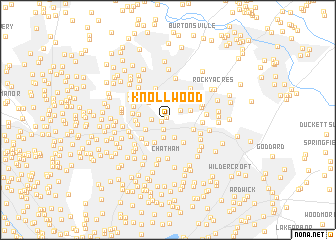
Knollwood (Maryland, United States - USA)Knollwood is a town in the Maryland region of United States - USA. An overview map of the region around Knollwood is displayed below.
regional and 3d topo map of Knollwood, United States - USA ::
Knollwood airports ::
The nearest airport is DCA - Ronald Reagan Washington Natl, located 20.5 km south of Knollwood.
Other airports nearby include ADW - Camp Springs Andrews Afb (Washington Dc Naf) (25.1 km south), BWI - Baltimore Washington Intl (30.1 km north east), IAD - Washington Dulles Intl (44.0 km west), APG - Aberdeen Phillips Aaf (83.9 km north east), Nearby towns ::
Lewiston (0.4km north west) //
Hillandale Forest (0.6km west) //
White Oak Manor (1.1km south) //
Hillandale (1.4km west) //
Powder Mill Estates (1.6km north east) //
Buck Lodge (2.0km south) //
College Park Woods (2.0km south) //
Oakview (2.2km south west) //
Sellman Estates (2.3km north east) //
Pine Hill (2.6km north west) //
Adelphi (2.8km south west) //
Cherry Hill (2.5km south east) //
Acredale (2.9km south east) //
Burnt Mills Knolls (2.6km west) //
Hillandale Heights (2.7km west) //
Avenel (3.2km south west) //
Northwest Park (3.1km south west) //
Cresthaven (2.9km west) //
Rolling Acres (3.7km north) //
Whitehouse (3.0km east) //
Hollywood (3.2km south east) //
Eleven Cedars (3.2km north east) //
Burnt Mills Hills (3.2km west) //
Home Acres (3.4km north east) //
White Oak (3.4km north west) //
Daniels Park (3.6km south east) //
Springbrook Manor (3.7km north west) //
Calverton (4.0km north east) //
Chestnut Hills (3.4km east) //
[all distances 'as the bird flies' and approximate] 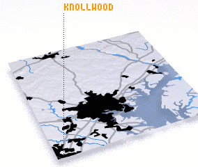 Places with similar names to Knollwood, United States - USA ::
Disclaimer :: Information on this page comes without warranty of any kind |
||
|
Where is Knollwood? Elevation and coordinates ::
Latitude (lat): 39°1'33"N Longitude (lon): 76°57'30"W
Elevation (approx.): 75m (map arrows pan, magnifying glasses zoom) |
||
|
Visiting Knollwood? Hotel/Accommodation ::
Book a hotel in Knollwood Travel Guide ::
rental cars ::
car rental offers GPS waypoint ::
download a GPX waypoint (PoI) of Knollwood for your GPS receiver
|
||