|
search place name
|
||
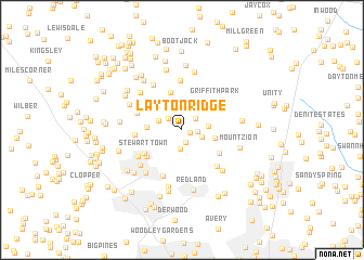
Layton Ridge (Maryland, United States - USA)Layton Ridge is a town in the Maryland region of United States - USA. An overview map of the region around Layton Ridge is displayed below.
regional and 3d topo map of Layton Ridge, United States - USA ::
Layton Ridge airports ::
The nearest airport is IAD - Washington Dulles Intl, located 38.6 km south west of Layton Ridge.
Other airports nearby include DCA - Ronald Reagan Washington Natl (40.1 km south), BWI - Baltimore Washington Intl (42.2 km east), ADW - Camp Springs Andrews Afb (Washington Dc Naf) (50.0 km south east), APG - Aberdeen Phillips Aaf (90.0 km east), Nearby towns ::
Burnham Hills (0.7km south east) //
Burnham Woods (1.0km north west) //
Rosewood Estates (1.3km south) //
Brooke Grove (1.2km east) //
Laytonsville (1.6km north east) //
Goshen Hunt Hills (1.6km north west) //
Hadley Farms (2.0km south) //
Laytonsville Knolls (1.8km south east) //
Goshen Hunt Estates (2.1km north west) //
Golf Estates (2.2km east) //
Claysville (2.8km east) //
Brook Hollow (3.1km north east) //
Goshen (2.8km west) //
Rocky Road Park (3.9km north) //
Ward Farm Estates (3.7km north west) //
Rolling Knolls (3.8km south east) //
Charlene (3.9km south west) //
Stewart Town (3.9km south west) //
Griffith Park (4.0km north east) //
Willett Estates (4.0km north east) //
Prathertown (3.8km west) //
Foxlair Acres (4.0km north west) //
Flower Hill (4.9km south) //
Seneca Upland (5.1km north) //
Montgomery Village (4.4km south west) //
Muncaster Manor (4.7km south east) //
Garfield Manor (5.2km north west) //
Whetstone (5.0km south west) //
Quail Valley (5.3km south west) //
[all distances 'as the bird flies' and approximate]  Places with similar names to Layton Ridge, United States - USA :: Disclaimer :: Information on this page comes without warranty of any kind |
||
|
Where is Layton Ridge? Elevation and coordinates ::
Latitude (lat): 39°12'4"N Longitude (lon): 77°9'19"W
Elevation (approx.): 165m (map arrows pan, magnifying glasses zoom) |
||
|
Visiting Layton Ridge? Hotel/Accommodation ::
Book a hotel in Layton Ridge Travel Guide ::
rental cars ::
car rental offers GPS waypoint ::
download a GPX waypoint (PoI) of Layton Ridge for your GPS receiver
|
||