|
search place name
|
||
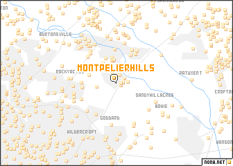
Montpelier Hills (Maryland, United States - USA)Montpelier Hills is a town in the Maryland region of United States - USA. An overview map of the region around Montpelier Hills is displayed below.
regional and 3d topo map of Montpelier Hills, United States - USA ::
Montpelier Hills airports ::
The nearest airport is BWI - Baltimore Washington Intl, located 20.7 km north east of Montpelier Hills.
Other airports nearby include ADW - Camp Springs Andrews Afb (Washington Dc Naf) (26.6 km south), DCA - Ronald Reagan Washington Natl (27.6 km south west), IAD - Washington Dulles Intl (54.1 km west), APG - Aberdeen Phillips Aaf (74.5 km north east), Nearby towns ::
Villages of Montpelier (0.6km east) //
Laurel Wood (0.7km south east) //
Birchwood Gardens (0.8km east) //
Montpelier (1.3km north) //
Oxford Green (1.4km north) //
Pheasant Run (1.2km north east) //
Montpelier Woods (1.5km east) //
South Laurel (2.2km north) //
Montpelier Forest (2.6km north west) //
North Creek Farms (2.6km west) //
Briarwood (3.5km north) //
Fox Rest (3.6km north) //
Snow Hill Manor (3.7km north) //
Contee (3.6km north west) //
Mistletoe Springs (4.1km north) //
Oak Crest (4.2km north) //
Muirkirk (3.7km west) //
Barbersville Trailer Park (4.8km north) //
Laurel (5.5km north) //
Maryland City (5.2km north east) //
Vansville (4.4km west) //
Ammendale (4.4km west) //
Town and Country (5.6km north) //
Greenbelt (5.7km south west) //
Pines of Laurel (5.8km north east) //
Mayfair (5.5km north west) //
Rosedale Park (5.2km south west) //
Robeys Farmlets (5.8km north west) //
Boxwood Village (5.8km south west) //
[all distances 'as the bird flies' and approximate] 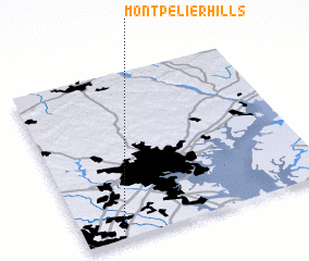 Places with similar names to Montpelier Hills, United States - USA :: Disclaimer :: Information on this page comes without warranty of any kind |
||
|
Where is Montpelier Hills? Elevation and coordinates ::
Latitude (lat): 39°3'0"N Longitude (lon): 76°50'45"W
Elevation (approx.): 59m (map arrows pan, magnifying glasses zoom) |
||
|
Visiting Montpelier Hills? Hotel/Accommodation ::
Book a hotel in Montpelier Hills Travel Guide ::
rental cars ::
car rental offers GPS waypoint ::
download a GPX waypoint (PoI) of Montpelier Hills for your GPS receiver
|
||