|
search place name
|
||
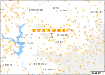
Morningside Heights (Maryland, United States - USA)Morningside Heights is a town in the Maryland region of United States - USA. An overview map of the region around Morningside Heights is displayed below.
regional and 3d topo map of Morningside Heights, United States - USA ::
Morningside Heights airports ::
The nearest airport is BWI - Baltimore Washington Intl, located 29.7 km south of Morningside Heights.
Other airports nearby include APG - Aberdeen Phillips Aaf (53.1 km east), DCA - Ronald Reagan Washington Natl (67.6 km south), ADW - Camp Springs Andrews Afb (Washington Dc Naf) (68.9 km south), IAD - Washington Dulles Intl (79.1 km south west), Nearby towns ::
Worthington Place South (0.4km south) //
Allyson Gardens (0.5km north west) //
Academy Lane (0.9km north) //
Owings Mills (1.0km south) //
Pleasant Hill (0.8km west) //
Garrison Ridge (1.2km south) //
Garrison Forest (1.1km south east) //
Tollgate (1.3km south west) //
Owings Ridge (1.6km north west) //
Gwynnbrook (1.8km north) //
Dunbar (1.8km south east) //
Hewitt Farms (1.6km west) //
Kendig Mill Station (2.1km north) //
Sarawoods (1.8km west) //
Belltown (1.9km west) //
Green Spring Junction (2.3km south east) //
Velvet Hills South (2.7km north) //
Cedarmere (2.1km north west) //
Delight (2.4km north west) //
Worthington Glen (3.0km north) //
Academy Acres (2.8km north west) //
Village of Painters Mill (3.3km south) //
Velvet Hills (3.3km north) //
Timber Grove (3.3km north west) //
Garrison (3.1km south east) //
Worthington Run (3.5km north) //
Hunters Glen South (3.3km north west) //
Worthington Park (3.6km north) //
Silverbrook Farm (3.3km south west) //
[all distances 'as the bird flies' and approximate] 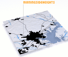 Places with similar names to Morningside Heights, United States - USA ::
// Morningside Heights (US)
Disclaimer :: Information on this page comes without warranty of any kind |
||
|
Where is Morningside Heights? Elevation and coordinates ::
Latitude (lat): 39°25'40"N Longitude (lon): 76°47'0"W
Elevation (approx.): 174m (map arrows pan, magnifying glasses zoom) |
||
|
Visiting Morningside Heights? Hotel/Accommodation ::
Book a hotel in Morningside Heights Travel Guide ::
rental cars ::
car rental offers GPS waypoint ::
download a GPX waypoint (PoI) of Morningside Heights for your GPS receiver
|
||