|
search place name
|
||
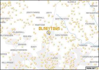
Olney Town (Maryland, United States - USA)Olney Town is a town in the Maryland region of United States - USA. An overview map of the region around Olney Town is displayed below.
regional and 3d topo map of Olney Town, United States - USA ::
Olney Town airports ::
The nearest airport is DCA - Ronald Reagan Washington Natl, located 34.0 km south of Olney Town.
Other airports nearby include BWI - Baltimore Washington Intl (34.6 km east), IAD - Washington Dulles Intl (41.1 km south west), ADW - Camp Springs Andrews Afb (Washington Dc Naf) (42.3 km south east), APG - Aberdeen Phillips Aaf (84.8 km north east), Nearby towns ::
Olney (0.5km south) //
Brookeville Knolls (0.6km north) //
Towne Centre Place (0.8km south) //
Camelback Village (0.9km south) //
Tanterra (1.0km north) //
Highlands of Olney (1.3km south) //
Olney Square (1.2km west) //
Timberland Estates (1.3km south east) //
Olney Oaks (1.3km south west) //
Williamsburg Village (1.5km south west) //
Hallowell (1.8km south) //
Briars Acres (1.5km west) //
Avenel (1.5km west) //
Olney Mill (2.0km north) //
Cherry Valley (2.1km south) //
Olney Estates (2.2km south east) //
Cashell Manor (2.3km south west) //
Brookeville (2.6km north) //
Olney Acres (2.2km south west) //
Cherrywood (2.5km south west) //
Norbrook Village (2.8km south) //
Oakdale (3.1km south) //
Norbeck Estates (3.0km south west) //
Holiday Hills (3.3km north) //
Cashell Woods (3.3km south) //
Dellabrooke Estates (3.1km north east) //
Brookemanor Estates (3.3km south west) //
Anscroft (3.8km south) //
Sunnymeade (4.1km north east) //
[all distances 'as the bird flies' and approximate] 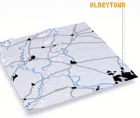 Places with similar names to Olney Town, United States - USA ::
Disclaimer :: Information on this page comes without warranty of any kind |
||
|
Where is Olney Town? Elevation and coordinates ::
Latitude (lat): 39°9'28"N Longitude (lon): 77°4'6"W
Elevation (approx.): 159m (map arrows pan, magnifying glasses zoom) |
||
|
Visiting Olney Town? Hotel/Accommodation ::
Book a hotel in Olney Town Travel Guide ::
rental cars ::
car rental offers GPS waypoint ::
download a GPX waypoint (PoI) of Olney Town for your GPS receiver
|
||