|
search place name
|
||
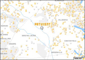
Patuxent (Maryland, United States - USA)Patuxent is a town in the Maryland region of United States - USA. An overview map of the region around Patuxent is displayed below.
regional and 3d topo map of Patuxent, United States - USA ::
Patuxent airports ::
The nearest airport is BWI - Baltimore Washington Intl, located 14.6 km north east of Patuxent.
Other airports nearby include ADW - Camp Springs Andrews Afb (Washington Dc Naf) (29.4 km south west), DCA - Ronald Reagan Washington Natl (34.5 km south west), IAD - Washington Dulles Intl (63.5 km west), APG - Aberdeen Phillips Aaf (67.0 km north east), Nearby towns ::
Piney Orchard (2.3km north east) //
Orchard Gate At Piney Orchard (2.9km north east) //
Orchard Point At Piney Orchard (2.9km north east) //
The Courts At Piney Orchard (3.1km north east) //
Chapelgate (3.2km north east) //
The Courts of Four Seasons (3.3km east) //
Odenton Heights (3.6km north east) //
Riden (3.7km north east) //
Odenton Park (3.6km east) //
Kings Ransom (4.0km north east) //
Four Seasons Estates (3.7km east) //
Patuxent Riding (4.6km south) //
Mistwood (3.7km east) //
Meadedale (4.8km north) //
Geraghty Village (5.0km north) //
Stoney Hill (4.4km north east) //
Odenton (4.5km north east) //
Maple Ridge (4.2km north east) //
Scotts Manor (4.4km north east) //
Jericho Park (4.8km south west) //
Kings Heights (4.5km north east) //
Academy Junction (5.1km north east) //
Bonaventure (5.0km north east) //
Hammond Park (4.8km north east) //
Conaways (5.1km south east) //
Colony Ridge (4.9km north east) //
Amberfield (5.4km south east) //
Jackson Grove (6.0km north east) //
Lions Gate (5.3km north east) //
[all distances 'as the bird flies' and approximate] 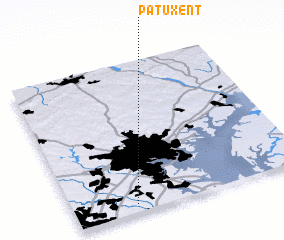 Places with similar names to Patuxent, United States - USA ::
// Patuxent (US)
Disclaimer :: Information on this page comes without warranty of any kind |
||
|
Where is Patuxent? Elevation and coordinates ::
Latitude (lat): 39°3'17"N Longitude (lon): 76°44'11"W
Elevation (approx.): 27m (map arrows pan, magnifying glasses zoom) |
||
|
Visiting Patuxent? Hotel/Accommodation ::
Book a hotel in Patuxent Travel Guide ::
rental cars ::
car rental offers GPS waypoint ::
download a GPX waypoint (PoI) of Patuxent for your GPS receiver
|
||