|
search place name
|
||
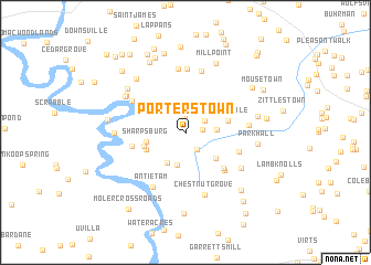
Porterstown (Maryland, United States - USA)Porterstown is a town in the Maryland region of United States - USA. An overview map of the region around Porterstown is displayed below.
regional and 3d topo map of Porterstown, United States - USA ::
Porterstown airports ::
The nearest airport is IAD - Washington Dulles Intl, located 62.0 km south of Porterstown.
Other airports nearby include DCA - Ronald Reagan Washington Natl (89.7 km south east), BWI - Baltimore Washington Intl (95.7 km east), ADW - Camp Springs Andrews Afb (Washington Dc Naf) (103.2 km south east), AOO - Altoona Blair Co (105.8 km north west), Nearby towns ::
Harvest Acres (1.6km north) //
Red Hill (1.4km east) //
Flickersville (2.0km south east) //
Antietam Heights (1.9km north east) //
Keedysville (2.5km north east) //
Eakles Mills (2.4km east) //
Burnside Acres (3.4km south) //
Horse Shoe Bend (3.3km south west) //
Mount Briar (3.5km south east) //
Sharpsburg (3.2km west) //
Forge Hill Estates (3.5km south west) //
Potomac Crest (3.5km south west) //
Springvale (3.6km east) //
Trego (4.7km south east) //
Rohrersville Station (4.9km south east) //
Confederate Hills (4.4km west) //
Locust Grove (4.6km south east) //
Mondell (5.2km north west) //
Antietam Overlook (6.3km north) //
Antietam (6.1km south west) //
Antietam Farmettes (6.4km north) //
Mount Carmel (5.0km east) //
Burtner (6.5km north) //
Chestnut Grove (6.4km south) //
Rohrersville (5.6km south east) //
Mercersville (5.9km north west) //
Taylors Landing (5.9km north west) //
Snyders Landing (5.6km west) //
Dogtown (6.3km north west) //
[all distances 'as the bird flies' and approximate] 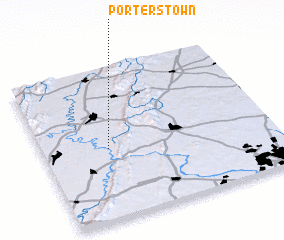 Places with similar names to Porterstown, United States - USA ::
// Porterstown (IE)
Disclaimer :: Information on this page comes without warranty of any kind |
||
|
Where is Porterstown? Elevation and coordinates ::
Latitude (lat): 39°27'57"N Longitude (lon): 77°42'48"W
Elevation (approx.): 135m (map arrows pan, magnifying glasses zoom) |
||
|
Visiting Porterstown? Hotel/Accommodation ::
Book a hotel in Porterstown Travel Guide ::
rental cars ::
car rental offers GPS waypoint ::
download a GPX waypoint (PoI) of Porterstown for your GPS receiver
|
||