|
search place name
|
||
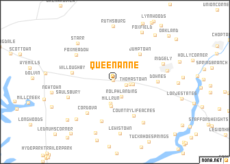
Queen Anne (Maryland, United States - USA)Queen Anne is a town in the Maryland region of United States - USA. An overview map of the region around Queen Anne is displayed below.
regional and 3d topo map of Queen Anne, United States - USA ::
Queen Anne airports ::
The nearest airport is DOV - Dover Afb, located 48.3 km north east of Queen Anne.
Other airports nearby include APG - Aberdeen Phillips Aaf (63.3 km north), BWI - Baltimore Washington Intl (67.9 km north west), SBY - Salisbury Ocean City Wicomico Rgnl (75.2 km south east), ADW - Camp Springs Andrews Afb (Washington Dc Naf) (80.0 km west), Nearby towns ::
Waljacks Corners (0.4km north west) //
Hillsboro (1.5km east) //
Hillsboro Estates (2.0km east) //
Horseshoe Estates (2.5km north) //
Rolph Landing (2.6km south) //
Thomas Town (2.4km east) //
Mill Run (3.6km south) //
Tappers Corner (4.0km south) //
Jumptown (5.5km north east) //
Country Life Acres (6.0km south east) //
Chapel Woods (6.6km south) //
Cordova (6.2km south west) //
Downes (5.4km east) //
Willoughby (5.7km west) //
Fox Meadow (6.5km north west) //
Saulsbury (6.4km south west) //
Griffin (7.5km south east) //
Ridgely (6.8km north east) //
Lewistown (8.5km south) //
Trinity (6.9km east) //
Chapel Station (7.8km south west) //
Starr (7.9km north west) //
Kittys Corner (8.7km south) //
Fox Field (8.8km north east) //
Morgans Neglect (8.6km south west) //
Buckels Corner (9.2km north east) //
Chaple (10.2km south west) //
Oakland (10.2km north east) //
[all distances 'as the bird flies' and approximate] 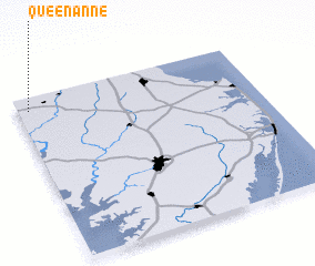 Places with similar names to Queen Anne, United States - USA ::
Disclaimer :: Information on this page comes without warranty of any kind |
||
|
Where is Queen Anne? Elevation and coordinates ::
Latitude (lat): 38°55'15"N Longitude (lon): 75°57'20"W
Elevation (approx.): 12m (map arrows pan, magnifying glasses zoom) |
||
|
Visiting Queen Anne? Hotel/Accommodation ::
Book a hotel in Queen Anne Travel Guide ::
rental cars ::
car rental offers GPS waypoint ::
download a GPX waypoint (PoI) of Queen Anne for your GPS receiver
|
||