|
search place name
|
||
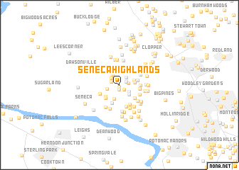
Seneca Highlands (Maryland, United States - USA)Seneca Highlands is a town in the Maryland region of United States - USA. An overview map of the region around Seneca Highlands is displayed below.
regional and 3d topo map of Seneca Highlands, United States - USA ::
Seneca Highlands airports ::
The nearest airport is IAD - Washington Dulles Intl, located 22.9 km south west of Seneca Highlands.
Other airports nearby include DCA - Ronald Reagan Washington Natl (35.7 km south east), ADW - Camp Springs Andrews Afb (Washington Dc Naf) (49.2 km south east), BWI - Baltimore Washington Intl (54.4 km east), APG - Aberdeen Phillips Aaf (104.8 km north east), Nearby towns ::
Darnestown (0.2km south) //
Darnestown Knolls (0.7km south) //
Highlands of Darnestown (0.9km south east) //
Bondbrook (0.9km north east) //
Browns Corner (1.1km north west) //
Ancient Oak West (1.1km east) //
Mitchells Range (1.4km north east) //
Pioneer Hills (1.4km north west) //
Brookmead (1.6km north west) //
Darnestown Hills (1.6km south east) //
Brookmead North (1.8km north west) //
Spring Meadows (1.6km west) //
Harvest Hunt Farm (1.9km south east) //
Hartley Hall Estates (2.3km south) //
Ancient Oak (1.9km east) //
Quail Run (1.9km east) //
Ancient Oak North (2.5km north east) //
Ridgeland Farm Estates (2.5km south west) //
Mountain View Estates (2.3km east) //
Woodbyran Farms (2.6km south west) //
Deakins Range (3.0km south) //
Travilah Acres (2.8km south east) //
Fox Hills Green (2.5km east) //
Fox Hills North (2.6km east) //
Harlow (2.8km south west) //
Potomac Chase Estates (3.3km south) //
Blackrock Mill (3.1km north west) //
Potomac Chase (2.9km south east) //
Farmlands (3.6km south) //
[all distances 'as the bird flies' and approximate] 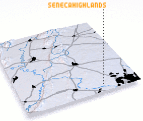 Places with similar names to Seneca Highlands, United States - USA :: Disclaimer :: Information on this page comes without warranty of any kind |
||
|
Where is Seneca Highlands? Elevation and coordinates ::
Latitude (lat): 39°6'20"N Longitude (lon): 77°17'28"W
Elevation (approx.): 132m (map arrows pan, magnifying glasses zoom) |
||
|
Visiting Seneca Highlands? Hotel/Accommodation ::
Book a hotel in Seneca Highlands Travel Guide ::
rental cars ::
car rental offers GPS waypoint ::
download a GPX waypoint (PoI) of Seneca Highlands for your GPS receiver
|
||