|
search place name
|
||
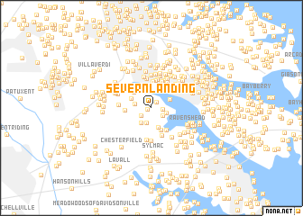
Severn Landing (Maryland, United States - USA)Severn Landing is a town in the Maryland region of United States - USA. An overview map of the region around Severn Landing is displayed below.
regional and 3d topo map of Severn Landing, United States - USA ::
Severn Landing airports ::
The nearest airport is BWI - Baltimore Washington Intl, located 16.0 km north west of Severn Landing.
Other airports nearby include ADW - Camp Springs Andrews Afb (Washington Dc Naf) (35.3 km south west), DCA - Ronald Reagan Washington Natl (44.3 km south west), APG - Aberdeen Phillips Aaf (59.3 km north east), IAD - Washington Dulles Intl (75.8 km west), Nearby towns ::
Harbor Oaks (0.4km south west) //
Valentine Creek (0.9km north east) //
Palisades on the Severn (1.1km east) //
Gotts (1.4km south west) //
Maynadier (1.4km south east) //
Palisades Park (1.6km south east) //
Cranberry Woods (1.9km south) //
Tall Timbers (1.6km west) //
Crownsville (2.0km south west) //
Belvoir Manor (2.4km south) //
Herald Harbor (2.1km north east) //
Arden on the Severn (2.6km north) //
Waterbury Heights (2.3km north west) //
Sunrise Beach (2.8km north) //
Indian Creek Estates (2.6km north west) //
Belvoir Farms (2.9km south) //
Spring Fields (2.5km west) //
Whitneys Landing (3.3km north) //
Kalmia Ridge (3.1km south east) //
Hollywood (3.4km north) //
Holly Point (3.4km north) //
Honeysuckle Ridge (3.5km south) //
Carrollton Manor (3.6km north) //
Lake Forest (3.7km north) //
Colchester on the Severn (3.5km north east) //
Bluff Point (3.7km north) //
Lakeland (3.9km north) //
Linstead-on-the-Severn (3.4km north east) //
Fair Winds (4.0km north) //
[all distances 'as the bird flies' and approximate] 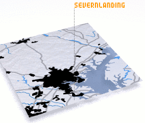 Places with similar names to Severn Landing, United States - USA :: Disclaimer :: Information on this page comes without warranty of any kind |
||
|
Where is Severn Landing? Elevation and coordinates ::
Latitude (lat): 39°2'40"N Longitude (lon): 76°35'25"W
Elevation (approx.): 52m (map arrows pan, magnifying glasses zoom) |
||
|
Visiting Severn Landing? Hotel/Accommodation ::
Book a hotel in Severn Landing Travel Guide ::
rental cars ::
car rental offers GPS waypoint ::
download a GPX waypoint (PoI) of Severn Landing for your GPS receiver
|
||