|
search place name
|
||
Shel-Mar Heights (Maryland, United States - USA)Shel-Mar Heights is a town in the Maryland region of United States - USA. An overview map of the region around Shel-Mar Heights is displayed below.
regional and 3d topo map of Shel-Mar Heights, United States - USA ::

Shel-Mar Heights airports ::
The nearest airport is IAD - Washington Dulles Intl, located 39.7 km south of Shel-Mar Heights.
Other airports nearby include DCA - Ronald Reagan Washington Natl (54.2 km south east), BWI - Baltimore Washington Intl (57.8 km east), ADW - Camp Springs Andrews Afb (Washington Dc Naf) (65.9 km south east), APG - Aberdeen Phillips Aaf (101.3 km east), Nearby towns ::
Rangers Woods (0.3km east) //
Hyattstown (0.7km south east) //
Old Orchard Estates (1.2km north east) //
Gibralter Acres (2.0km north west) //
Sugarloaf Meadows (2.3km north) //
Rolling Green (2.1km north east) //
Sugarloaf Vista (2.0km east) //
Hillview Acres (3.1km north) //
Hickory Hill (2.8km east) //
Green Valley (3.2km north east) //
Heritage Hills (3.2km north west) //
Fairfield Heights (3.7km north east) //
Thurston (3.2km west) //
Big Woods Estates (4.2km north) //
Carolina Hills (3.3km west) //
The Ponderosa (3.3km east) //
Glen Cameron Estates (4.1km south west) //
Thompsons Corner (5.0km south) //
Miles Corner (4.9km south east) //
Burnt Hickory (4.2km north west) //
Oakridge (5.3km north) //
Kingsley (4.4km south east) //
Urbana (5.0km north west) //
Comus (5.1km south west) //
Centerville (5.5km north) //
Pleasant Grove (5.3km north east) //
Green Hills (5.0km north east) //
Sweadner (5.3km north east) //
Loch Haven (5.3km north east) //
[all distances 'as the bird flies' and approximate] 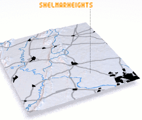 Places with similar names to Shel-Mar Heights, United States - USA :: Disclaimer :: Information on this page comes without warranty of any kind |
||
|
Where is Shel-Mar Heights? Elevation and coordinates ::
Latitude (lat): 39°17'13"N Longitude (lon): 77°19'18"W
Elevation (approx.): 150m (map arrows pan, magnifying glasses zoom) |
||
|
Visiting Shel-Mar Heights? Hotel/Accommodation ::
Book a hotel in Shel-Mar Heights Travel Guide ::
rental cars ::
car rental offers GPS waypoint ::
download a GPX waypoint (PoI) of Shel-Mar Heights for your GPS receiver
|
||