|
search place name
|
||
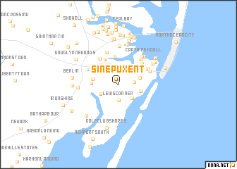
Sinepuxent (Maryland, United States - USA)Sinepuxent is a town in the Maryland region of United States - USA. An overview map of the region around Sinepuxent is displayed below.
regional and 3d topo map of Sinepuxent, United States - USA ::
Sinepuxent airports ::
The nearest airport is SBY - Salisbury Ocean City Wicomico Rgnl, located 31.5 km west of Sinepuxent.
Other airports nearby include WWD - Wildwood Cape May Co (80.1 km north), DOV - Dover Afb (94.7 km north), NHK - Patuxent River Nas (110.2 km west), MIV - Millville Muni (117.3 km north), Nearby towns ::
Holly Grove (2.2km north) //
Lewis Corner (2.6km south) //
Morris Mobile Home Park (2.0km east) //
Silver Lake Mobile Home Park (2.8km north east) //
Snug Harbor (2.7km south east) //
Dills Acres (2.6km south west) //
Mystic Harbor (2.8km east) //
Eagles Nest Mobile Home Park (3.0km east) //
Green Ridge Mobile Home Park (3.5km north east) //
Highland Park (3.3km west) //
Trappe (3.4km west) //
Albatross Mobile Home Park (4.4km north) //
Kitts Hill (3.7km north west) //
Grays Corner (4.3km north) //
Greenwood Place (4.4km north east) //
Lake Haven Mobile Home Park (4.7km north west) //
Sea Isle Mobile Home Park (4.4km north east) //
Herring Landing (4.9km north east) //
Taylorville (5.2km north) //
Briddletown (4.5km north west) //
West Ocean City (4.4km north east) //
Cape Isle Of Wight (5.3km north east) //
Captains Knoll (5.4km north east) //
Sherwood Forest (6.1km north) //
Bay Shore Acres (5.4km north east) //
Salt Grass Cove (6.4km north) //
Germantown (5.1km west) //
Harbor Mist Estates (5.8km north east) //
Wood Duck Isle (7.0km north) //
[all distances 'as the bird flies' and approximate] 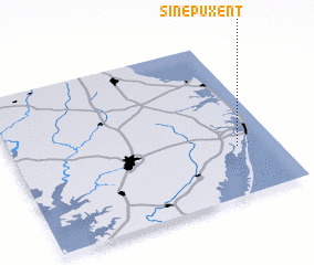 Places with similar names to Sinepuxent, United States - USA :: Disclaimer :: Information on this page comes without warranty of any kind |
||
|
Where is Sinepuxent? Elevation and coordinates ::
Latitude (lat): 38°18'47"N Longitude (lon): 75°9'8"W
Elevation (approx.): 4m (map arrows pan, magnifying glasses zoom) |
||
|
Visiting Sinepuxent? Hotel/Accommodation ::
Book a hotel in Sinepuxent Travel Guide ::
rental cars ::
car rental offers GPS waypoint ::
download a GPX waypoint (PoI) of Sinepuxent for your GPS receiver
|
||