|
search place name
|
||
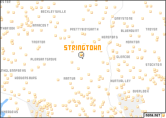
Stringtown (Maryland, United States - USA)Stringtown is a town in the Maryland region of United States - USA. An overview map of the region around Stringtown is displayed below.
regional and 3d topo map of Stringtown, United States - USA ::
Stringtown airports ::
The nearest airport is BWI - Baltimore Washington Intl, located 42.3 km south of Stringtown.
Other airports nearby include APG - Aberdeen Phillips Aaf (48.3 km east), MDT - Harrisburg Intl (71.1 km north), DCA - Ronald Reagan Washington Natl (82.7 km south), ADW - Camp Springs Andrews Afb (Washington Dc Naf) (83.5 km south), Nearby towns ::
Yeoho (1.9km north) //
Butler (2.3km south) //
Coopersville (2.1km west) //
Mount Carmel Farms (2.9km north) //
Berean (2.6km north west) //
Cedar Grove (3.2km north) //
Worthington Manor (3.7km south) //
Arden Valley (3.4km north east) //
Pine Hill Farms (4.4km south) //
Mount Carmel (4.2km north west) //
Bacon Hall (3.7km north east) //
Belfast (3.5km east) //
Flickerwood (4.3km north east) //
Evna (4.4km north east) //
Gentsville (5.1km south) //
Lambourne Downs (4.9km south east) //
Prettyboy Garth (5.6km north) //
Priceville (4.4km east) //
Prettyboy (5.7km north) //
Brandy Springs (5.3km north east) //
Greencroft (5.4km south east) //
Thompson Estates (5.6km north west) //
Mantua (5.9km south) //
Western Run (5.5km south east) //
Retreat Farms (4.8km east) //
Friends View (5.1km south east) //
Haletown (5.7km north west) //
Shawan (6.6km south) //
Hope Meadows (5.8km north east) //
[all distances 'as the bird flies' and approximate] 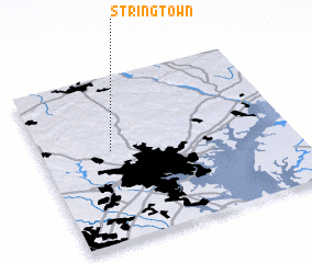 Places with similar names to Stringtown, United States - USA ::
// Stringtown (US)
// Stringtown (US)
// Stringtown (US)
// Stringtown (US)
// Stringtown (US)
// Stringtown (US)
// Stringtown (US)
// Stringtown (US)
// Stringtown (US)
// Stringtown (US)
Disclaimer :: Information on this page comes without warranty of any kind |
||
|
Where is Stringtown? Elevation and coordinates ::
Latitude (lat): 39°33'16"N Longitude (lon): 76°43'9"W
Elevation (approx.): 139m (map arrows pan, magnifying glasses zoom) |
||
|
Visiting Stringtown? Hotel/Accommodation ::
Book a hotel in Stringtown Travel Guide ::
rental cars ::
car rental offers GPS waypoint ::
download a GPX waypoint (PoI) of Stringtown for your GPS receiver
|
||