|
search place name
|
||
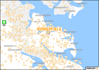
Summerfield (Maryland, United States - USA)Summerfield is a town in the Maryland region of United States - USA. An overview map of the region around Summerfield is displayed below.
regional and 3d topo map of Summerfield, United States - USA ::
Summerfield airports ::
The nearest airport is BWI - Baltimore Washington Intl, located 14.1 km west of Summerfield.
Other airports nearby include ADW - Camp Springs Andrews Afb (Washington Dc Naf) (46.9 km south west), APG - Aberdeen Phillips Aaf (47.6 km north east), DCA - Ronald Reagan Washington Natl (54.9 km south west), IAD - Washington Dulles Intl (84.1 km west), Nearby towns ::
Blossom Hills (0.6km south west) //
Chesterfield Gardens (0.7km west) //
Orr Acres (0.7km east) //
Riviera Isle (0.9km north west) //
Sharonville (0.9km south west) //
Chesterfield (0.9km west) //
Jacobsville (1.2km south) //
Rockview Beach (1.2km north) //
Rock Anna (1.4km north) //
Water Oak Forest (1.4km north) //
Rock Creek Landing (1.2km north west) //
Chesterfield Plaza (1.2km west) //
Rockhill Beach (1.5km north west) //
Water Oak Cove (1.6km north) //
Deerfield (1.7km south west) //
Pine Grove Village (2.0km north) //
Villa Tuscana (1.6km west) //
Rock Hill Beach (2.0km north) //
Seaborne Estates (2.0km south) //
Water Oak Point (2.1km north) //
Bell Forest (1.9km south east) //
Sanders Park (2.1km north east) //
Hillside Park (2.1km north west) //
Woodland Beach (2.2km north east) //
Armiger (1.9km south west) //
Pine Crest (2.5km south) //
Country Place (2.0km west) //
Cottage Grove Beach (2.5km north) //
Mansion House Manor (2.0km west) //
[all distances 'as the bird flies' and approximate]  Places with similar names to Summerfield, United States - USA ::
// Summerfield (US)
// Summerfield (US)
// Summerfield (US)
// Sommerfeld (DE)
// Sommerfeld (DE)
// Sommerfeld (DE)
// Sommerfelde (DE)
// Summerfield (US)
// Summerfield (US)
// Summerfield (US)
Disclaimer :: Information on this page comes without warranty of any kind |
||
|
Where is Summerfield? Elevation and coordinates ::
Latitude (lat): 39°7'55"N Longitude (lon): 76°30'53"W
Elevation (approx.): 20m (map arrows pan, magnifying glasses zoom) |
||
|
Visiting Summerfield? Hotel/Accommodation ::
Book a hotel in Summerfield Travel Guide ::
rental cars ::
car rental offers GPS waypoint ::
download a GPX waypoint (PoI) of Summerfield for your GPS receiver
|
||