|
search place name
|
||
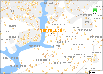
Tantallon (Maryland, United States - USA)Tantallon is a town in the Maryland region of United States - USA. An overview map of the region around Tantallon is displayed below.
regional and 3d topo map of Tantallon, United States - USA ::
Tantallon airports ::
The nearest airport is DCA - Ronald Reagan Washington Natl, located 14.4 km north of Tantallon.
Other airports nearby include ADW - Camp Springs Andrews Afb (Washington Dc Naf) (15.7 km north east), IAD - Washington Dulles Intl (45.8 km north west), BWI - Baltimore Washington Intl (58.2 km north east), NHK - Patuxent River Nas (71.3 km south east), Nearby towns ::
Tantallon Square (0.9km north east) //
Tantallon North (1.1km north west) //
Kimberly Woods (1.4km north) //
Tantallon Hills (1.6km south) //
Warburton Oaks (1.5km north east) //
Battersea on the Bay (1.9km north) //
Tantallon South (1.5km east) //
Warburton Manor (1.6km south east) //
Broadwater Estates (2.0km north) //
Riverview (1.6km west) //
Piscataway Hills (2.1km south east) //
Fort Washington Estates (2.2km south west) //
Silesia (2.2km north east) //
Fort Washington (2.2km south west) //
Riverview Estates (2.2km north west) //
Harmony Hall (2.5km north) //
Piscataway Estates (2.4km south east) //
Chapel Hill (2.4km east) //
Fort Washington Forest (2.6km south east) //
Jomar Acres (2.6km east) //
Calvert Manor (3.8km south) //
Indian Queen Estates (3.8km north) //
Friendly Farms (3.2km north east) //
Collingwood (3.2km west) //
Broad Creek (3.9km north) //
Valley View (3.3km east) //
Old Fort Acres (3.3km east) //
Arcturus (3.4km north west) //
Friendly Hills (4.0km north east) //
[all distances 'as the bird flies' and approximate] 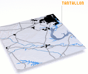 Places with similar names to Tantallon, United States - USA ::
Disclaimer :: Information on this page comes without warranty of any kind |
||
|
Where is Tantallon? Elevation and coordinates ::
Latitude (lat): 38°43'26"N Longitude (lon): 77°0'36"W
Elevation (approx.): 16m (map arrows pan, magnifying glasses zoom) |
||
|
Visiting Tantallon? Hotel/Accommodation ::
Book a hotel in Tantallon Travel Guide ::
rental cars ::
car rental offers GPS waypoint ::
download a GPX waypoint (PoI) of Tantallon for your GPS receiver
|
||