|
search place name
|
||
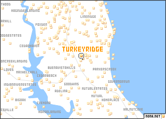
Turkey Ridge (Maryland, United States - USA)Turkey Ridge is a town in the Maryland region of United States - USA. An overview map of the region around Turkey Ridge is displayed below.
regional and 3d topo map of Turkey Ridge, United States - USA ::
Turkey Ridge airports ::
The nearest airport is NHK - Patuxent River Nas, located 33.0 km south east of Turkey Ridge.
Other airports nearby include ADW - Camp Springs Andrews Afb (Washington Dc Naf) (38.1 km north west), DCA - Ronald Reagan Washington Natl (52.0 km north west), BWI - Baltimore Washington Intl (69.6 km north), IAD - Washington Dulles Intl (87.8 km north west), Nearby towns ::
Central Village (0.2km north east) //
Watson Estates (0.5km south west) //
Rose Hill (0.8km north east) //
Willowbrook Hills (1.0km north east) //
Queensberry (1.2km north east) //
Clahamman Hills (1.3km north east) //
Prince Frederick (1.5km south west) //
Kingswood Estates (1.5km north east) //
Bay Terrace (1.4km east) //
Hidden Valley (1.6km south east) //
Stoakley (1.8km west) //
Calvert Towne (2.5km south) //
The Knolls (2.4km south west) //
Deer Crossing (2.5km east) //
Woodridge (3.1km south west) //
Buckler Trailer Park (2.8km north west) //
Hunting Creek Farms (3.4km north west) //
Hunters Ridge (3.1km west) //
Robshire Manor (3.8km north west) //
German Chapel Woods (4.1km south) //
Meadow Oaks (3.5km north west) //
Lord Cecil Woods (4.1km north west) //
Turners Field (4.2km north) //
Parran Hunt Estates (4.3km north) //
Huntingtown Estates (4.3km north west) //
Pine Trailer Park (4.6km south) //
Quiet Meadows (3.8km north west) //
Ravenshead (4.4km north west) //
Double Oak Estates (4.0km east) //
[all distances 'as the bird flies' and approximate] 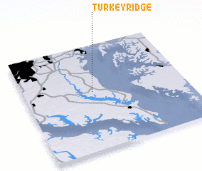 Places with similar names to Turkey Ridge, United States - USA ::
Disclaimer :: Information on this page comes without warranty of any kind |
||
|
Where is Turkey Ridge? Elevation and coordinates ::
Latitude (lat): 38°33'10"N Longitude (lon): 76°34'40"W
Elevation (approx.): 43m (map arrows pan, magnifying glasses zoom) |
||
|
Visiting Turkey Ridge? Hotel/Accommodation ::
Book a hotel in Turkey Ridge Travel Guide ::
rental cars ::
car rental offers GPS waypoint ::
download a GPX waypoint (PoI) of Turkey Ridge for your GPS receiver
|
||