|
search place name
|
||
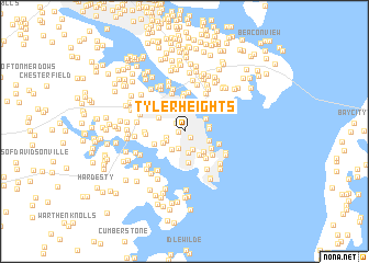
Tyler Heights (Maryland, United States - USA)Tyler Heights is a town in the Maryland region of United States - USA. An overview map of the region around Tyler Heights is displayed below.
regional and 3d topo map of Tyler Heights, United States - USA ::
Tyler Heights airports ::
The nearest airport is BWI - Baltimore Washington Intl, located 28.1 km north west of Tyler Heights.
Other airports nearby include ADW - Camp Springs Andrews Afb (Washington Dc Naf) (36.0 km south west), DCA - Ronald Reagan Washington Natl (48.3 km west), APG - Aberdeen Phillips Aaf (63.1 km north east), NHK - Patuxent River Nas (75.1 km south), Nearby towns ::
Primrose Acres (0.5km west) //
Victor Haven (0.8km south east) //
Truxton Heights (1.0km north west) //
Harness Woods (1.8km south) //
Robinwood (1.6km west) //
Old Annapolis Neck (1.9km south) //
Romar Estates (1.7km south west) //
Hillsmere Shores (2.2km south) //
Annapolis (2.2km north) //
Harkness Creek Park (2.1km south west) //
Bay Ridge Junction (2.2km north) //
Rundelac Farm (2.1km south west) //
Elktonia (2.0km east) //
Bembe Beach (2.0km east) //
Eastport (2.2km north east) //
Annapolis Roads (2.2km south east) //
Keys Farm (2.6km south east) //
Kitty Creek (2.7km south east) //
Forest Villa (2.5km north west) //
Blackwalnut Cove (2.9km south east) //
Hillsmere Estates (3.2km south) //
Anchorage (2.7km south east) //
The Ridings (2.7km south west) //
West Annapolis (3.5km north) //
Walnut Lake (3.2km south east) //
Admiral Heights (3.3km north west) //
Chrisland At Annapolis Cove (3.3km south east) //
Lands End (3.0km south east) //
Wardour (3.9km north) //
[all distances 'as the bird flies' and approximate] 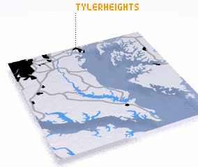 Places with similar names to Tyler Heights, United States - USA ::
// Dowler Heights (US)
// Tyler Heights (US)
Disclaimer :: Information on this page comes without warranty of any kind |
||
|
Where is Tyler Heights? Elevation and coordinates ::
Latitude (lat): 38°57'34"N Longitude (lon): 76°29'54"W
Elevation (approx.): 15m (map arrows pan, magnifying glasses zoom) |
||
|
Visiting Tyler Heights? Hotel/Accommodation ::
Book a hotel in Tyler Heights Travel Guide ::
rental cars ::
car rental offers GPS waypoint ::
download a GPX waypoint (PoI) of Tyler Heights for your GPS receiver
|
||