|
search place name
|
||
Tylers Summit (Maryland, United States - USA)Tylers Summit is a town in the Maryland region of United States - USA. An overview map of the region around Tylers Summit is displayed below.
regional and 3d topo map of Tylers Summit, United States - USA ::

Tylers Summit airports ::
The nearest airport is BWI - Baltimore Washington Intl, located 41.4 km south east of Tylers Summit.
Other airports nearby include APG - Aberdeen Phillips Aaf (64.1 km east), DCA - Ronald Reagan Washington Natl (72.3 km south), ADW - Camp Springs Andrews Afb (Washington Dc Naf) (76.2 km south), IAD - Washington Dulles Intl (77.1 km south west), Nearby towns ::
Flagg Meadows (0.6km south) //
Centennial Homestead (0.7km east) //
Charolais Acres (1.2km south west) //
Hillandale Trailer Park (1.5km north) //
Knoll View Acres (1.6km south west) //
Todd Village Trailer Park (1.5km north east) //
Ricketts Ridge (1.4km east) //
Starview Estates (1.4km west) //
Ridgemont (2.0km north) //
Cedarhurst (1.7km east) //
Cold Saturday (1.8km south east) //
Piedmont Acres (1.8km north east) //
Worth Acres (2.2km south) //
Pheasant Run (2.2km north) //
Deer Park Estates (1.7km west) //
Walnut Grove Mills (2.0km north west) //
Eastview Estates (2.0km west) //
Beaver Ridge (2.4km north west) //
Home Farm (2.0km west) //
Red Oak Hills West (2.6km south) //
Finksburg (2.0km east) //
Sullivans Trailer Park (2.6km north) //
Sumor Estates (2.4km south west) //
Liberty View Farms (2.4km south east) //
Kirkner Estates (2.3km west) //
True Estates (2.3km west) //
Carroll County Trails (3.0km north) //
Shirley Manor (3.1km north) //
Red Oak Hills (3.1km south) //
[all distances 'as the bird flies' and approximate] 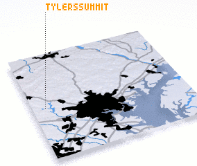 Places with similar names to Tylers Summit, United States - USA :: Disclaimer :: Information on this page comes without warranty of any kind |
||
|
Where is Tylers Summit? Elevation and coordinates ::
Latitude (lat): 39°29'45"N Longitude (lon): 76°54'47"W
Elevation (approx.): 184m (map arrows pan, magnifying glasses zoom) |
||
|
Visiting Tylers Summit? Hotel/Accommodation ::
Book a hotel in Tylers Summit Travel Guide ::
rental cars ::
car rental offers GPS waypoint ::
download a GPX waypoint (PoI) of Tylers Summit for your GPS receiver
|
||